Here's what Florida can expect when remnants of Sara arrive this week
Sara's leftovers will bring rain to Florida
FOX 13 News Meteorologist Jim Weber says Sara is just a remnant low at this point. However, the left over moisture from Sara will combine with a cold front and increase rain chances over Florida later this week. No tropical formation is expected over the next seven days and hurricane season ends in 12 days, according to Weber.
TAMPA, Fla. - The National Hurricane Center says Sara is no longer a tropical system, but its remnants will likely bring significant rain to Florida mid-week.
The NHC stopped issuing advisories on the system early Monday, saying "Sara no longer has a well organized circulation."
Sara was a tropical storm at one point before downgrading to a tropical depression as it dumped heavy rain across parts of Central America and Mexico.
What's the timeline for rain?
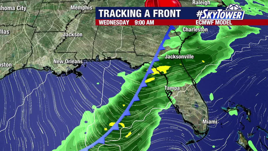
FOX 13 Meteorologist Dave Osterberg says the tropical moisture will move north into the Gulf of Mexico, then merge with a cold front and move east through Florida on Wednesday.
"At this point, there could be a couple of stronger storms, mainly to the north of us," Osterberg said. "But we are going to get a line of rain Wednesday."

Forecasters say the remnants of Sara will move through Florida on Wednesday, bringing rain ahead of another cold front.
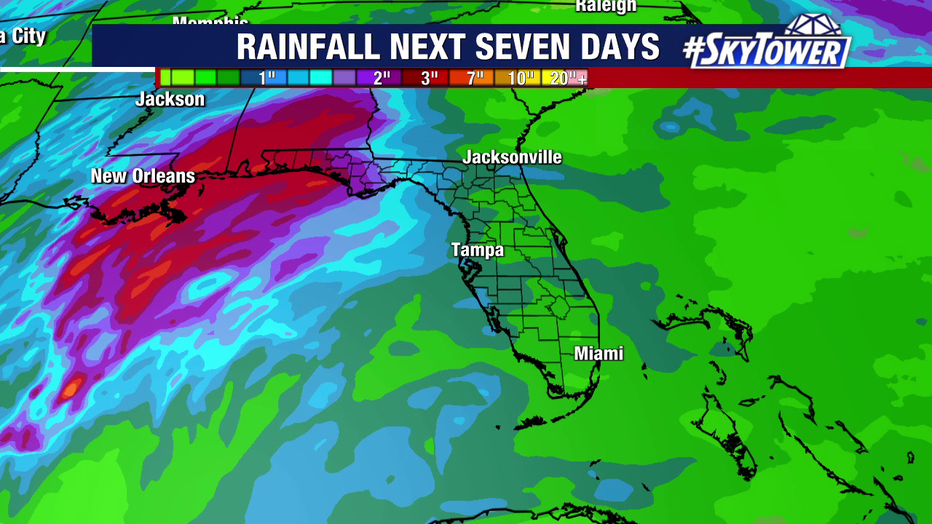
The heaviest rainfall will occur along the northern Gulf coast, from Louisiana to the Florida panhandle, on Tuesday and Wednesday. Some areas could see up to 5 inches of rain.
Rainfall in the Tampa Bay area will start Wednesday morning, according to Osterberg, and continue for several hours until cooler and drier air moves in later on Wednesday.

The remnants of Sara will bring significant rainfall to a stretch of the U.S. Gulf coast, with the largest amounts occurring northwest of the Tampa Bay area.
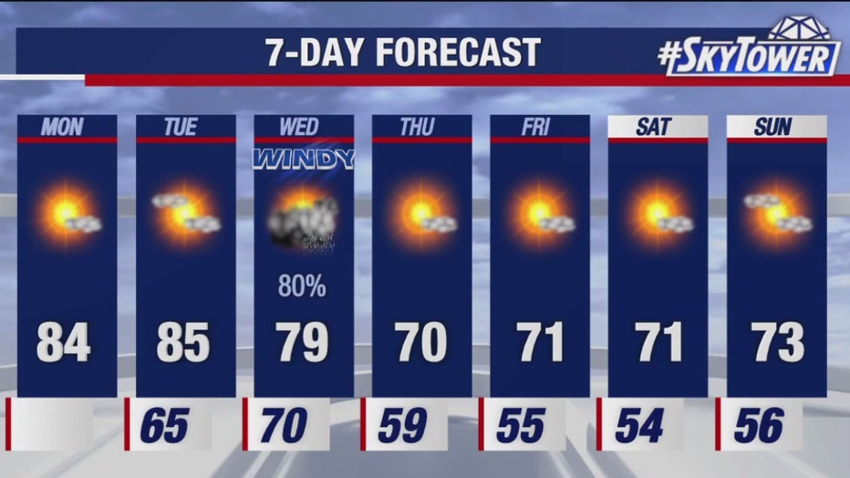
Then by Thursday, high temperatures will be in the low 70s and will stay there at least through the weekend.

The forecast calls for rain on Wednesday, followed by much drier and cooler air from Thursday through the weekend.
STAY CONNECTED WITH FOX 13 TAMPA BAY:
- Download the FOX Local app for your smart TV
- Download the FOX 13 News app for breaking news alerts, latest headlines
- Download the SkyTower Radar app
- Sign up for FOX 13’s daily newsletter

