How El Niño, 'freakish' warm oceans may impact hurricane season
NOAA releases 2023 Atlantic hurricane season outlook
NOAA's Climate Prediction Center is predicting a near-average Atlantic hurricane season in 2023. FOX Weather hurricane specialist Bryan Norcross breaks down the latest hurricane season outlook released on Thursday. (Credit: FOX Weather)
Hurricane forecasters are factoring in the ongoing "super El Niño" for this year’s hurricane season, with warming in the Pacific and Atlantic oceans at near-record levels.
Sea-surface temperature anomalies were enough for NOAA to officially declare the El Niño climate pattern underway on June 8.
An El Niño forms when sea-surface temperature anomalies reach at least 0.5 degrees Celsius warmer than average in a critical region of the equatorial Pacific Ocean. According to NOAA, the latest measurements recorded the anomaly at 0.9 degrees Celsius above average, and the El Niño continues to intensify.
It marks the first time the world has been in an El Niño year since 2019. The climate event can significantly impact the weather, including the Pacific and Atlantic hurricane seasons.
Some forecast models predict the 2023-24 event as a "super El Niño," in which water temperatures in the central and eastern Pacific reach at least 2 degrees Celsius above average.

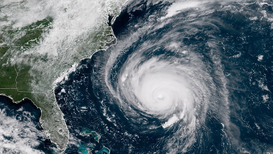
In this satellite image provided by U.S. National Oceanic and Atmospheric Administration (NOAA), Hurricane Florence churns through the Atlantic Ocean toward the U.S. East Coast on September 12, 2018. Florence slowed its approach to the U.S. today and
FOX Weather Hurricane Specialist Bryan Norcross said the Pacific is warm but not a record yet. However, the eastern Atlantic temperatures are unprecedented.
WHAT ARE EL NINO AND LA NINA CLIMATE PATTERNS?
"If the eastern Atlantic stays super warm, and we get a moderate or strong El Niño as expected, it will be a combination of conditions that we haven't seen before," Norcross said. "That makes predicting what will happen more difficult than normal."
Norcross said "freakish" is an excellent word to describe the warm temperatures in the eastern Atlantic Ocean, which is currently averaging 87 degrees and has even been in the 90s recently.
RELATED: 2023 Atlantic hurricane season: Here's what to know about this year's storms
"It’s not just that we have not seen these temperatures lately; it’s that we’ve never seen this kind of warming in the eastern Atlantic," Norcross said.
With historic warming anomalies, Norcross said it's too early to tell how El Niño will factor into this year's Atlantic hurricane season.
"Because we haven’t seen this kind of warming before, exactly how this is going to change the weather pattern is kind of unknown," Norcross said.
Other climate factors could also impact the tropics this year.
Bryan Norcross: Odds are high for strong El Niño pattern
Warm ocean temperatures could fuel intense hurricanes during the current El Niño conditions. Only a few years on record have been warmer during June.
Norcross said, so far, there hasn't been a lot of Saharan dust this year, which has a cooling effect on the Atlantic. However, the dust season is just beginning and runs through August.
"It's possible that Saharan dust will move over the Atlantic and cool the water," Norcross said.
It’s too early to tell how this will affect ocean temperatures.
Find more updates on this story at FOXWeather.com.

