

Hurricane Lee prompts watches for New England
Hurricane Lee sets sights on New England
FOX 13 Meteorologist Jim Weber is keeping an eye on three areas in the tropics, including Hurricane Lee, which is expected to make landfall in New England on Saturday. He says Hurricane Lee is losing its well-defined eye and starting to weaken into an extra tropical system. According to Weber, hurricane watches and tropical storm warnings have been posted ahead of Lee’s arrival over the weekend. Weber says Hurricane Margot is doing loops in the Atlantic and will eventually fade away. He’s also watching Invest 97, which is on the cusp of becoming the next tropical system. If it earns a name, it will be called Nigel.
TAMPA, Fla. - New England is bracing for the impacts of Hurricane Lee ahead of the storm’s expected arrival on Saturday.
According to the National Hurricane Center, hurricane conditions and coastal flooding are possible in portions of Maine, southern News Brunswick and western Nova Scotia on Saturday prompting a hurricane watch for the area.
As of 11 a.m. on Thursday, Hurricane Le was located at 30.4 degrees longitude and 68.3 degrees latitude. It had maximum sustained winds of 90 miles an hour and was moving north at 14 miles an hour.
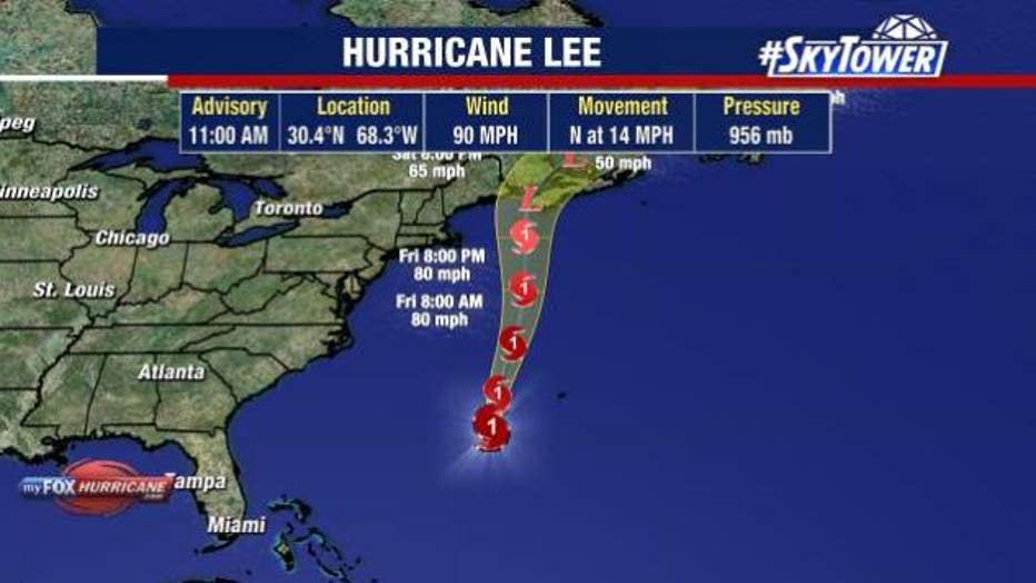
Hurricane Lee is expected to weaken to a tropical storm before making landfall.
FOX 13 Meteorologist Dave Osterberg says Hurricane Lee keeps wrapping bursts of convection around its center and it was elongated on Thursday morning.
Osterberg notes that Hurricane Lee is a very large storm with hurricane-force winds stretching out 120 miles from its center.
Watch: Lee's monstrous eyewall captured by Hurricane Hunters in electric video
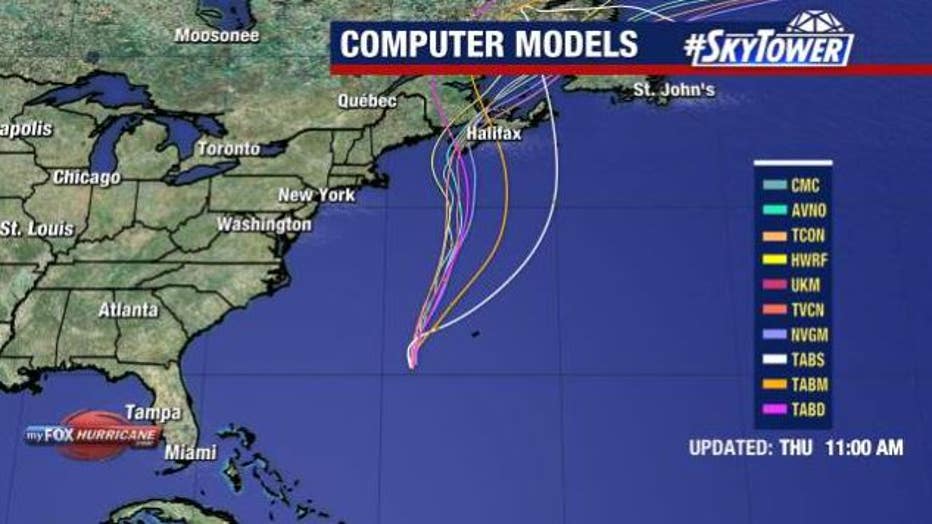
Computer models show Lee making landfall in the area of New England on Saturday.
He said it was a Category 2 hurricane on Thursday morning and expects it to weaken to a tropical storm before it enters the Bay of Fundy over the weekend and makes landfall just west of Nova Scotia.
Osterberg is also keeping an eye on Hurricane Margot, which remained a Category 1 storm on Thursday morning.
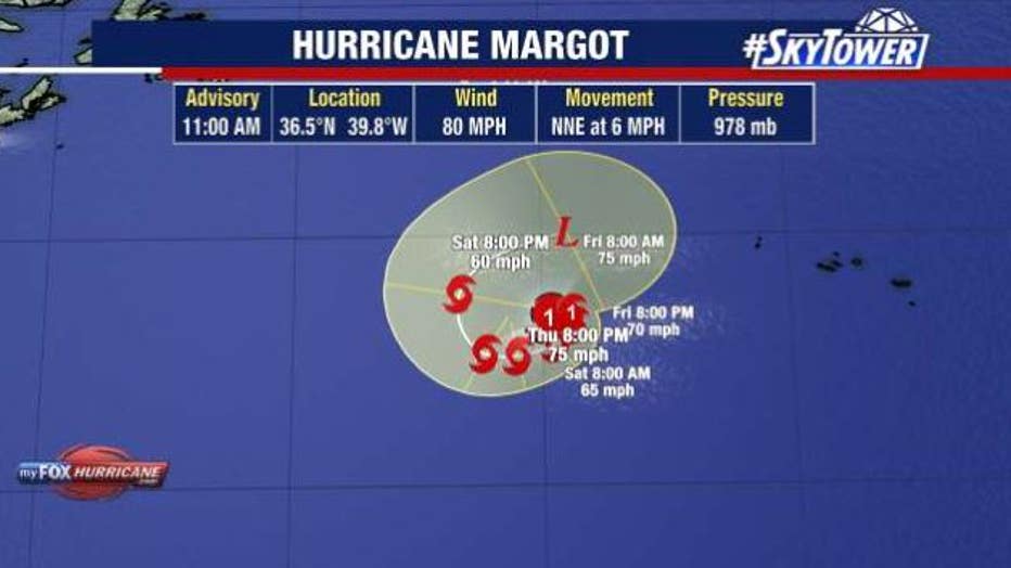
Hurricane Margot is expected to stay over open waters.
Hurricane Margot was located at 36.5 degrees longitude and 39.8 degrees latitude. It had winds of 80 miles an hour and was moving north-northeast at six miles an hour.
Osterberg says Hurricane Margot will stay over open waters.