Hurricane Lee transitioning to extratropical system ahead of New England landfall
Tropical Depression 15 forms as Hurricane Lee prepares for landfall
FOX 13 Meteorologist Jim Weber is watching the newly formed Tropical Depression 15 as Hurricane Lee makes its way toward New England. He expects Lee to make landfall on Saturday as an extratropical storm. Weber also has his eye on Margo, which has been downgraded to a tropical storm and is making loops in the Atlantic as it weakens. He is also watching the newly formed Tropical Depression 15, which he expects to strengthen into a major hurricane that could threaten Bermuda.
TAMPA, Fla. - Hurricane Lee is weakening ahead of its predicted landfall in the News England area this weekend.
As of 8 p.m. on Friday, Hurricane Lee was located at 38.3 degrees longitude and 66.0 degrees latitude.
It was a Category 1 hurricane with maximum sustained winds of 80 miles an hour and was moving north-northeast at 20 miles per hour.

FOX 13 Meteorologist Dave Osterberg says Lee doesn’t even look like a hurricane anymore because a lot of the convection is gone and it is in the process of transitioning from a hurricane to an extratropical system.
RELATED: What was the last hurricane to make landfall in Maine?
He says in a tropical system the winds are confined to an area around the center of the storm, but with an extratropical system the highest winds are not in the center. Instead, they are fanned out and can be found at the edges of the storm.

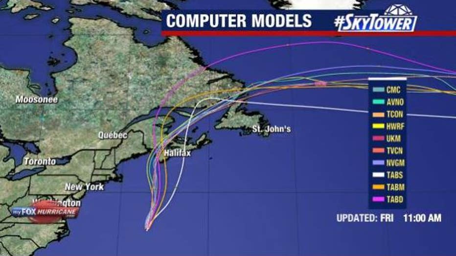
Computer models show Lee making landfall in the New England area over the weekend.
According to Osterberg, the tropical storm-force winds spread out about 340 miles from the center of the system.
He says that even though Lee will be an extratropical system when it makes landfall, there will be tropical storm-force winds from Cape Cod through Halifax, Nova Scotia.
Osterberg cautions that the winds will bring in a lot of water into the Bay of Fundy as it makes landfall on Saturday.

Meanwhile, Osterberg says Margot has been downgraded from a hurricane to a tropical storm, and it is expected to stay over open waters and eventually dissipate.
Tropical Depression 15 formed Friday morning, and it is located at 15.4 degrees longitude and 44.0 degrees latitude. It had maximum sustained winds of 35 miles an hour and was moving northwest at 13 miles an hour.

The National Hurricane Center expects it to strengthen into a hurricane.
The next name on the list is Nigel.

