

Hurricane Milton: Cat. 1 storm moves off the coast of Florida after widespread impacts
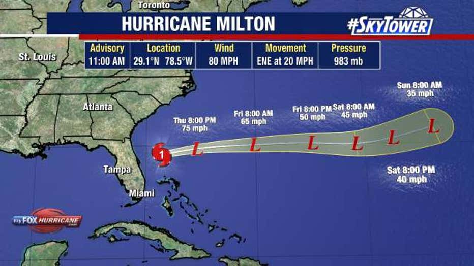
TAMPA, Fla. - Hurricane Milton has moved off the coast of Florida after making landfall on Siesta Key as a major hurricane on Wednesday night, with hurricane and tropical storm warnings discontinued for Florida's west coast on Thursday morning.
As of 11 a.m., Milton had maximum sustained winds of 80 miles per hour.
Milton reached the west-central coast of Florida at around 8:30 p.m. Wednesday. When it made landfall, the hurricane had maximum sustained winds of 120 miles per hour.
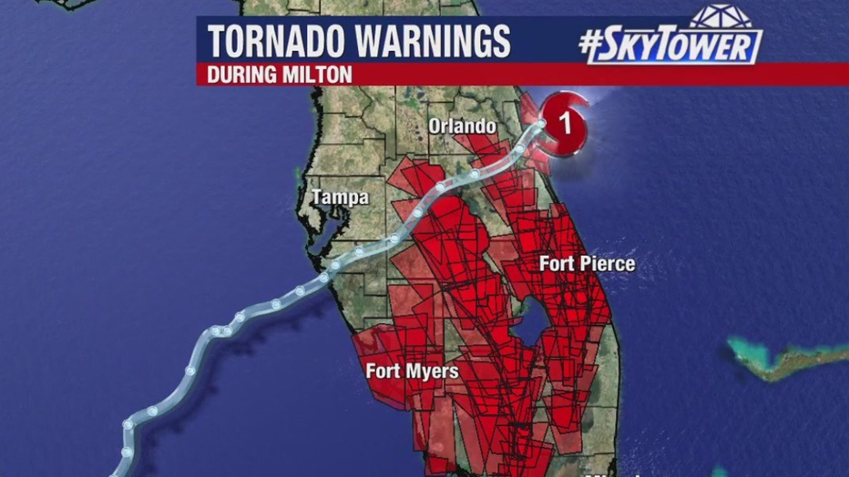
According to FOX 13 News Meteorologist Valerie Mills, the most tornado warnings ever issued in a single day in Florida was on Wednesday.
Milton was last reported moving east-northeast at 20 miles per hour over the Atlantic.
Hurricane Milton winds
Official readings show wind gusts topped 100 miles an hour in several spots as Milton hit the Gulf coast.
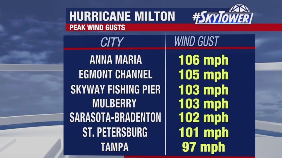
Hurricane-force winds extended outward up to 35 miles from the center of Milton and tropical-storm-force winds extended outward up to 205 miles as the storm moved through Florida.
Hurricane force wind gusts were felt across portions of the Tampa Bay area into early Thursday, with tropical storm force winds extending across a large stretch of the state.
READ: Florida Power Outages: Hurricane Milton knocks out power to millions
According to FOX 13 News Chief Meteorologist Paul Dellegatto, winds will diminish on Thursday.
Rainfall totals
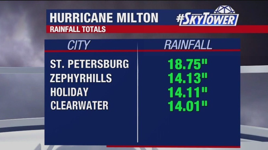
Parts of the Tampa Bay area saw more than a foot of rain, with St. Pete coming in at 18.75 inches. The heaviest rainfall occurred north of Milton's eye and has led to severe flooding in many places.
Storm surge
The worst storm surge ranged from Milton's eye to the south, while points north of the eye did not experience major storm surge.
- Venice: 7.45 feet
- Fort Myers: 5.27 feet
- Naples: 5.08 feet
STAY CONNECTED WITH FOX 13 TAMPA:
- Download the FOX Local app for your smart TV
- Download the FOX 13 News app for breaking news alerts, latest headlines
- Download the SkyTower Radar app
- Sign up for FOX 13’s daily newsletter