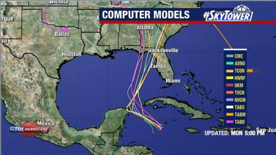
Potential Tropical Cyclone Nine expected to become Helene as it gets closer to Florida
TAMPA, Fla. - Potential Tropical Cyclone Nine is expected to become Helene on Tuesday as the system starts to intensify as it inches closer to Florida.
Tropical Storm Watch was issued for the Southwest Florida area, including Bonita Beach down to the Florida Keys. Those watches could be extended up the state Tuesday morning.
FOX 13 Chief Meteorologist Paul Dellegatto said he is expecting the Tampa Bay area to be under a watch by Tuesday evening.
Potential Tropical Cyclone Nine could reach Category 2 hurricane strength by the time it makes landfall.
Tropical Storm Watches
A Tropical Storm Watch was issued for the Dry Tortugas and the Lower Florida Keys south of the Seven-Mile Bridge. That has since been extended to include parts of Southwest Florida, all the way up to Bonita Beach.
A Tropical Storm watch means that tropical storm conditions are possible within the watch area, generally within 48 hours.
STAY CONNECTED: Download the free FOX 13 News app for Live SkyTower Radar, forecast videos, and more weather coverage
As of 11 p.m. on Monday, it was at 18.4 N and 82.4 W with top winds of 35 miles an hour and was moving north northwest at six miles an hour.

When will the storm make landfall?
Potential Tropical Cyclone Nine is expected to intensify into a hurricane before it makes landfall likely somewhere in the Big Bend Area of Florida.
While it is too soon to predict exactly how strong it will become and where exactly it will make landfall, there is the potential for life-threatening storm surge and damaging hurricane-force winds along the coast of the Florida panhandle and Florida’s west coast.
According to the National Hurricane Center, storm surge and hurricane watches will likely be issued for those areas Tuesday morning.
The Hurricane Hunters were flying into the storm on Monday to get a better idea of the environment and determine if the storm has a closed center of circulation.
READ: Potential Tropical Cyclone 9: Citrus County opens sandbag locations ahead of storm
Dellegatto expects Hurricane Helene to hit Florida's Big Bend Area as a Category 2 hurricane sometime on Thursday afternoon.

He says it will be a pretty quickly hitting storm, but the weather will extend out a lot from the center.
Dellegatto stresses that even though he doesn't believe it will make landfall on Florida's west coast, he is not completely ruling it out just yet.
When will the Bay Area begin feeling the effects of the storm?
According to Dellegatto, the Bay Area will begin to feel the storm's impacts starting on Wednesday night with the worst weather on Thursday. He says Bay Area residents can expect a lot of heavy rain and coastal flooding as winds turn to the south and southwest as the storm goes by.
Governor Ron DeSantis declared a state of emergency for Florida on Monday as several counties and cities began opening sandbag locations.
Meteorologists encourage people to look at the forecast cone not the line in the middle, because even if the storm doesn’t make landfall on the west coast of Florida, the Bay Area will still feel its impacts, such as bands of rain and wind.
After making landfall, the storm will head into Georgia. It will likely bring damaging wind and rain to the Peach State because it is a large system and will take a while to spin down.
FOX 13 meteorologists are watching an area in the Atlantic that is likely to form into something, but say it will stay out over open water.
STAY CONNECTED WITH FOX 13 TAMPA BAY:
- Download the FOX Local app for your smart TV
- Download the FOX 13 News app for breaking news alerts, latest headlines
- Download the SkyTower Radar app
- Sign up for FOX 13’s daily newsletter

