Potential Tropical Cyclone 16 forms and takes aim at the Carolinas
Potential Tropical Cyclone 16 takes aim at Carolinas
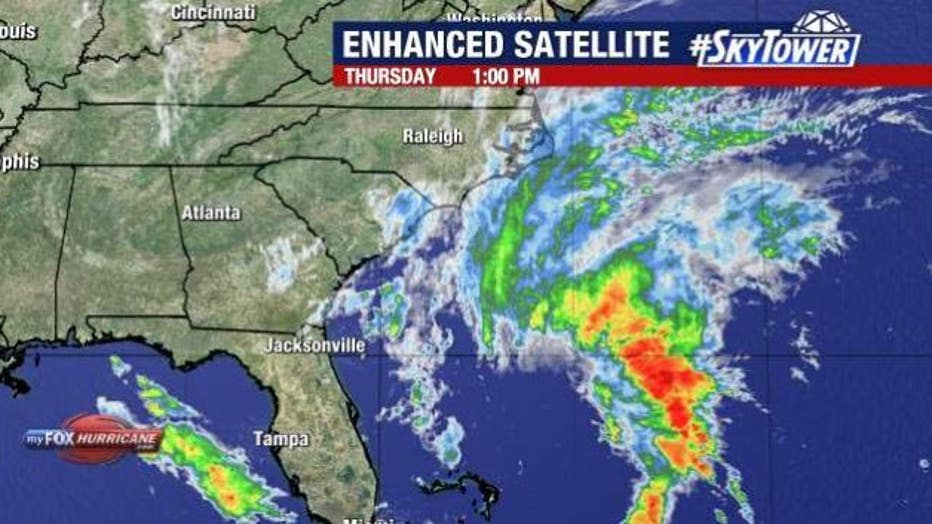
FOX 13 Meteorologist Jim Weber is keeping an eye on Potential Tropical Cyclone 16, which formed off the Southeastern United States Thursday morning.
TAMPA, Fla. - Potential Tropical Cyclone 16 formed Thursday morning off the coast of the southeastern portion of the United States.
As off 11 a.m. it was located at 28.7 degrees longitude and 75.9 degrees latitude.
The system had maximum sustained winds of 35 miles per hour and was moving north at nine miles an hour.

According to the National Hurricane Center, the area of low pressure is expected to bring tropical storm conditions and the potential for life-threatening storm surge to portions of the Southeast and Mid-Atlantic coasts.
READ: Parts of Sunset Beach closing so crews can begin dune restoration post Hurricane Idalia
Tropical storm warnings have been issued for the Carolina coastline.
FOX 13 Meteorologist Jim Weber says it is not a tropical system yet, but all the models show it gaining tropical characteristics over the next 24- 36 hours as it works its way north toward the Carolinas.

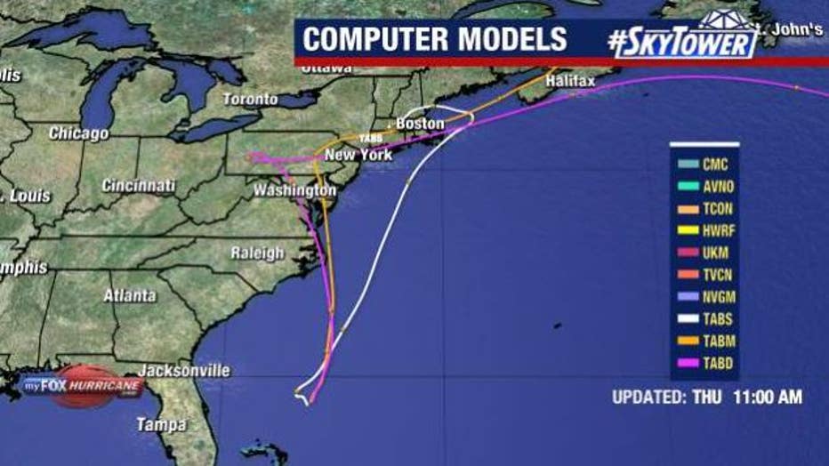
Computer models show Potential Tropical Cyclone 16 moving north after forming off the Southeast coastline.
Weber says it is expected to strengthen and may become Tropical Storm Ophelia ahead of landfall.
He says after if makes landfall in the Carolinas, the system will bend back around and head out over open water where the temperatures are cooler forcing it to lose its tropical characteristics.
READ: Hillsborough County firefighters help rural Big Bend communities impacted by Hurricane Idalia
Conditions are expected to deteriorate in the Carolinas on Friday morning as some of the rain bands and gusty winds make their way on shore.

The outer rain bands and winds from Potential Tropical Cyclone 16 are expected to impact the Carolinas beginning Friday morning.
According to Weber, the storm will officially make landfall on Saturday in the Carolinas and impact weather up into Virginia, Maryland and Delaware as well.
Potential Tropical Cyclone 16 will not have a direct impact on Florida, but it will bring drier weather and lessen the humidity levels over the weekend.

