

Study aims to analyze coastal flooding in Bay Area to improve storm preparation
TAMPA, Fla. - The National Weather Service is conducting a study to better understand coastal flooding in Tampa Bay.
"Our coastline unfortunately is very vulnerable to storm surge," said NWS Tampa Bay-Ruskin Meteorologist Austen Flannery.
The east coast of Florida sits at the edge of a continental shelf.
"So when you used to get a really big storm or hurricane, some of the water can be displaced downward, some of that comes onshore. What that means is the risk of storm surge is confined to a smaller area of the coast," Flannery said.
Tampa Bay sits further back on the continental shelf.
"We can see a significant amount of water moving quite a substantial distance inland and there’s definitely a need to understand what that looks like," he explained.
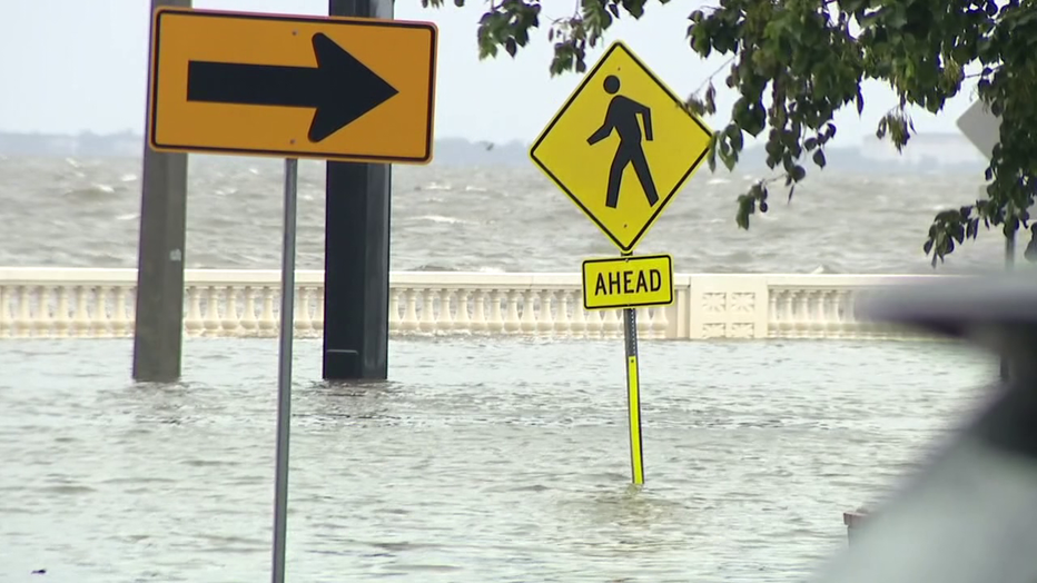
The study is in the very early stages, working to gather data. While it looks at Tampa Bay as a whole, some areas of focus include Anna Maria Island, Bayshore Blvd, and the Shore Acres neighborhood.
Gary Grudzinskas has lived in Shore Acres for 30 years.
"We've been flooded before, but the recovery seemed a lot quicker," he said.
But the past year, between Hurricane Idalia and the winter storm, has been especially difficult. Grudzinskas had to completely gut his home.
"Take out the walls, you take out the floor and that's a bit disruptive, as you can imagine. But this time I did some extra work. I raised the floors in some areas and leveled them out and waterproofed the bottom two feet of my walls," he said.
He said while Shore Acres is more prone to flooding, he's grateful NWS is looking at other communities, too.
READ: Driver accused of ramming Hillsborough deputy facing upgraded charge, mother arrested
"I think they should take a closer look because it's going to affect a lot more than low-lying Shore Acres. Pretty soon it's going to affect everybody that lives within, say, ten feet of sea level. Right here we're about three feet above sea level," he said. "You can't stop the tide. So there's got to be more long term solutions to what the future is going to look like with water rising."
NWS meteorologists are working to develop new flood maps specific to communities.
"There is a long-term goal that we are working through, the ability to actually map out where the water is going to go down at a community level, at levels that we can’t currently do," he said. "We do obviously in a hurricane situation. We do storm surge flooding, and we produce these risk maps that kind of highlight the areas where there could be potential for flooding. But that’s very, very big picture because the science still isn’t in a place yet where we can place a more localized understanding of that."
SIGN UP: Click here to sign up for the FOX 13 daily newsletter
WATCH FOX 13 NEWS