

Tracking the Tropics: Chances of development slowly increasing for disturbance in the central Atlantic
TAMPA, Fla. - There's about a 40% chance that a wave in the central Atlantic could become a tropical depression or tropical low in the next couple of days, according to FOX 13 News Meteorologist Valerie Mills.
Mills says as the disturbance gets closer to the Leeward Islands, there will be a better idea of what the storm might do over the next few days.
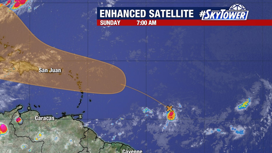
"We do expect it to continue on a west-northwest track, but the models are kind of all over the place as we are still several days out at this point. Most of the models take it up to the east of the state of Florida and up the east coast, but this is still a couple of days out," explained Mills. "So we are going to be watching it very closely as conditions are pretty favorable in the next few days for some additional strengthening."
Water temperatures are in the mid 80s as the storm approaches the Caribbean and wind shear is not too strong right now.
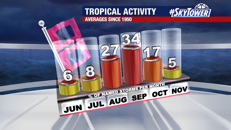
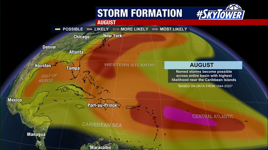
Mills says the number of named storms typically jumps up in August.
"So it's really important to remember we've got about 90% of the hurricane season to go, June and July typically are quiet months," she shared.
SIGN UP: Click here to sign up for the FOX 13 daily newsletter