

Tracking the Tropics: Invest 95L likely to become tropical depression or storm this weekend
Tropical wave in Atlantic could become depression
FOX 13 Meteorologist Nash Rhodes gave an update on two tropical waves - one in the Atlantic and one in the Caribbean. One spinning towards the Gulf of Mexico could become a tropical depression but won't pose much of an issue for the U.S. The second wave, still quite far away from the U.S. and Florida, is expected to form over the weekend and could become the second named storm of the season.
TAMPA, Fla. - The National Hurricane Center continues to monitor two tropical waves, and one of them now has an increased chance of development by the end of the week.
‘The tropics are picking up again,’ the NHC wrote in a Tweet after days of low activity stemming from Saharan dust moving through the Atlantic.
READ: Tracking the Tropics: Watching 2 tropical waves with chance for development
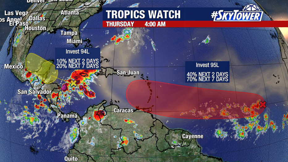
Invest 95L, a system working its way west, now several hundred miles east of the Windward Islands and Africa, has a medium-high chance of development over the next week.

Invest 95L
NHC reported that the storm has become better organized since Wednesday with a more concentrated area of thunderstorms.
They said environmental conditions should be ‘unusually conducive’ for late June across the central and western Atlantic. They give the storm a 40 percent chance of development over the next 48 hours and a 70 percent chance of development through the next 7 days.

Invest 94L
Meanwhile, a little closer to home, Invest 94L moves rapidly westward at 25 mph through the western Caribbean Sea as it approaches the Bay of Campeche in the Southwest Gulf of Mexico.
According to the NHC, this storm has a 10 percent chance of development over the next 48 hours and a 20 percent chance of development through the next 7 days.
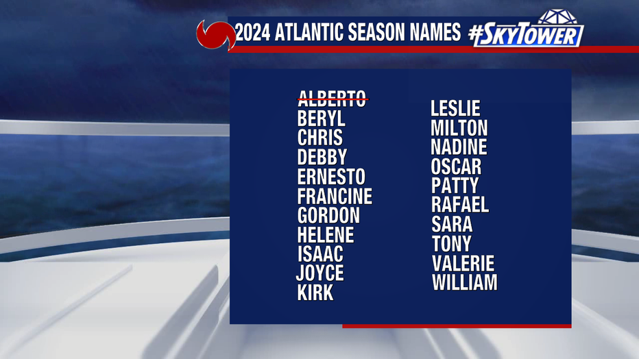
Should either of these systems develop into a named storm, they would take ‘Beryl' after our first tropical storm of the 2024 hurricane season, Alberto.