

Tropical disturbance in Atlantic could form into Ernesto as odds of development increase
PREVIOUS: Invest 98L could become next named storm
A tropical disturbance in the Atlantic has gained quite a bit of development odds over the last couple of days, according to FOX 13 News Meteorologist Valerie Mills. Mills says there's an 80% chance of development within the next seven days.
TAMPA, Fla. - A tropical disturbance in the Atlantic is expected to develop into the next named storm.
The disturbance, designated Invest 98L, is located several hundred miles east of the Lesser Antilles and has a high chance of development. Invest is simply a term used by the National Hurricane Center to indicate an area in the tropics that is being closely investigated for possible development.

Hurricane season 2024 Atlantic Basin tropical cyclone names. (FOX Weather)
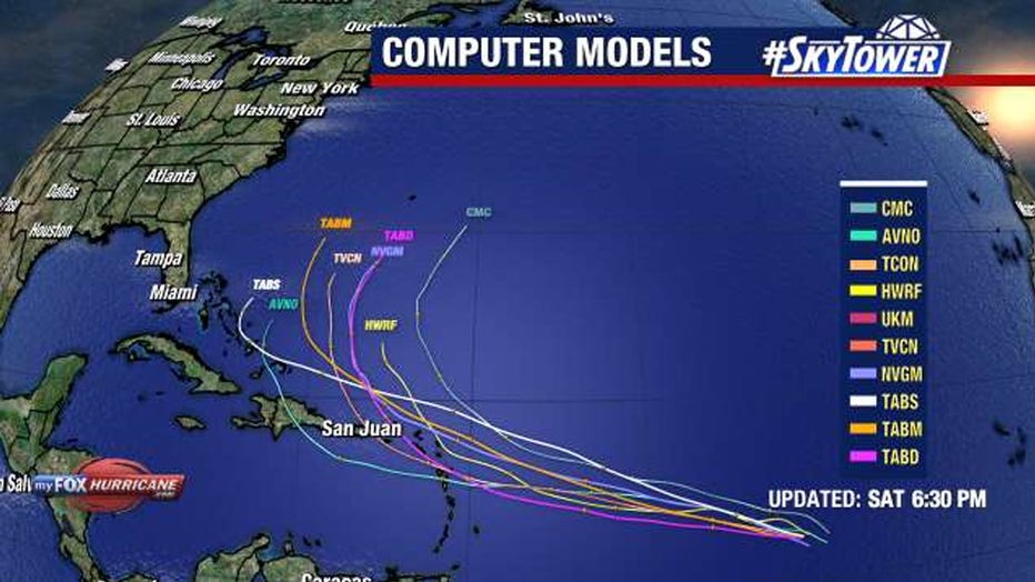
The disturbance could form by early next week as the system approaches the Lesser Antilles, according to the NHC. Once winds reach at least 39 mph, it will take the next name on the Atlantic naming list, Ernesto.
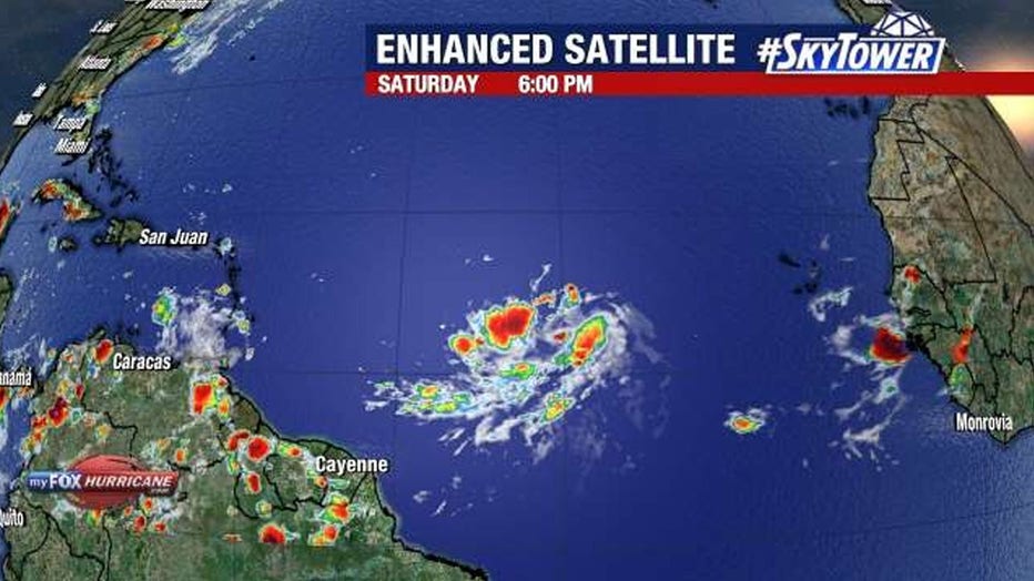
There's a 40% chance the disturbance will develop in the next two days. However, there's an 80% chance of development within the next seven days.
It is too early to say with certainty if future Ernesto will have any impacts on the U.S. mainland. However, people in the U.S. territories of Puerto Rico and the U.S. Virgin Islands could see impacts from the storm by as early as Tuesday.
"We still have a couple of days to continue to watch this, but a lot of things working in its favor where conditions are favorable for additional strengthening. As we look ahead to next week, it's important to remember we have 90% of the hurricane season still ahead of us, so we don't hit the peak of the Atlantic season until September 10th," said FOX 13 News Meteorologist Valerie Mills.
Forecasters say anyone with interests in the Caribbean should also closely monitor forecasts.
FOX Weather contributed to this story. Read more at FOXWeather.com.
SIGN UP: Click here to sign up for the FOX 13 daily newsletter