First fall cold front bringing cooler, drier air to Florida

Tampa weather | Fall cold front moving in
FOX 13 meteorologist Valerie Mills has the latest on a cold front moving into Florida, plus how that front will help keep any tropical threats away from the state.
TAMPA, Fla. - Cooler, drier air is on the way to Florida just one week after Hurricane Milton brought widespread heavy rain and wind to the Tampa Bay area.
FOX 13 Meteorologist Valerie Mills says the first fall cold front will be a dry system over land, with any potential showers staying over open water.
Breezy conditions will pick up through the day on Wednesday, which will make it feel even cooler on Thursday morning, according to Mills.
How cold will it get?
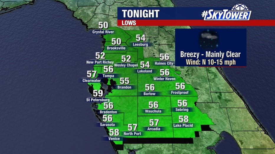
Thursday is expected to be the coldest morning for the Bay Area since March, with lows in the 50s in many spots.
Afternoon highs will stay in the upper 70s in parts of the Bay Area on Wednesday, with Thursday set to be the coolest morning since March. Lows will be in the 50s across much of the region, Mills says.
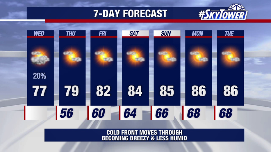
Afternoon highs are dropping to the upper 70s near 80, with lows in the 50s by Thursday, as a cold front moves over Florida.
Thursday's high will hover around 80 degrees before we start to warm up again, returning to the mid-80s and staying dry in time for the weekend.
Humidity will drop significantly, as well, with much lower dew points in the coming days.
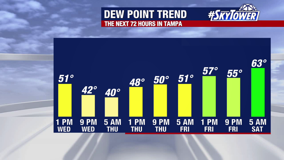
The cold front moving into Florida will bring much drier air, with a big drop in dew points the rest of the week.
What does the cold front mean for the tropics?
The National Hurricane Center is watching two disturbances as of Wednesday morning.
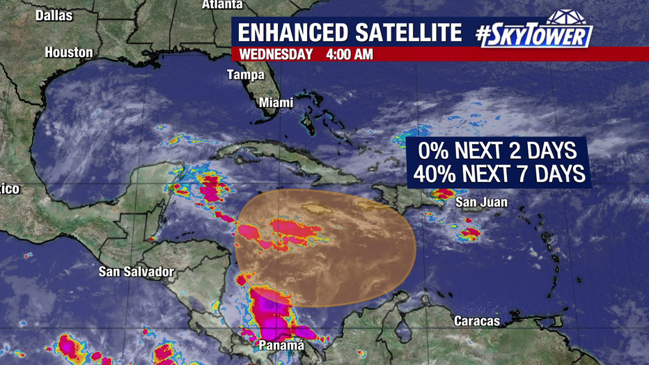
The National Hurricane Center is watching two disturbances, but neither is expected to impact Florida
Invest 94L is moving west over the Atlantic Ocean, with the NHC giving it a 50 percent chance to develop over the next seven days.
Models show Invest 94L moving toward Puerto Rico and Hispaniola, then staying south as the cold front over Florida will help block the wave from turning toward the state.
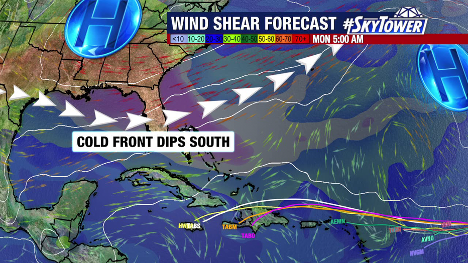
The cold front moving over Florida will help keep any tropical threats away from the state over the coming days.
The NHC is also monitoring a disturbance near Central America with a 20 percent chance of development in the next week. If it develops, it will likely curve west and stay away from the mainland U.S.
STAY CONNECTED WITH FOX 13 TAMPA BAY:
- Download the FOX Local app for your smart TV
- Download the FOX 13 News app for breaking news alerts, latest headlines
- Download the SkyTower Radar app
- Sign up for FOX 13’s daily newsletter

