Forecasters watching three areas for potential tropical development
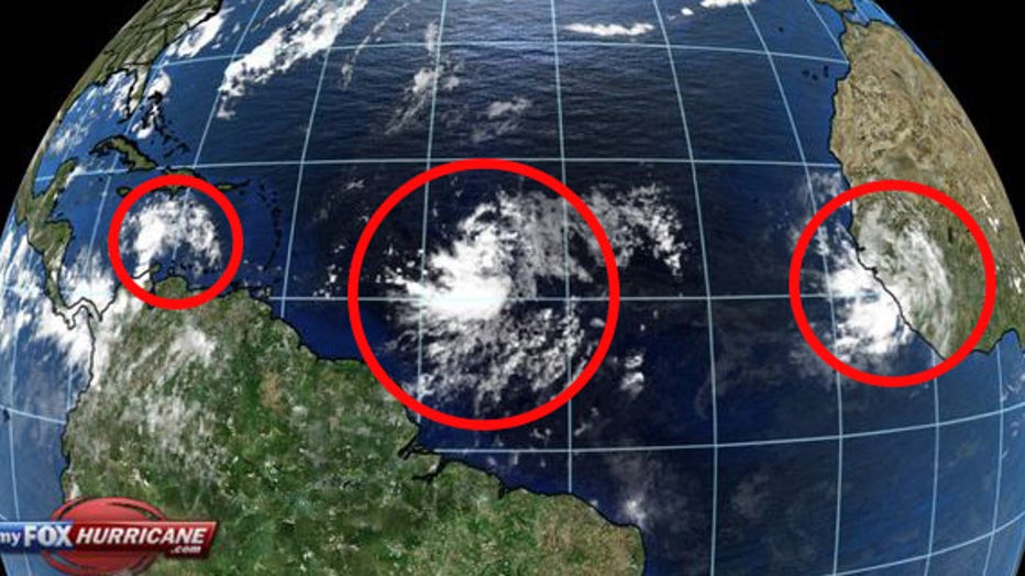
TAMPA, Fla. - Meteorologists with the National Hurricane Center say there are now three areas of likely tropical development in the Atlantic as the busy 2020 hurricane season rolls on.
The two closest areas are both expected to become tropical depressions in the next few days.
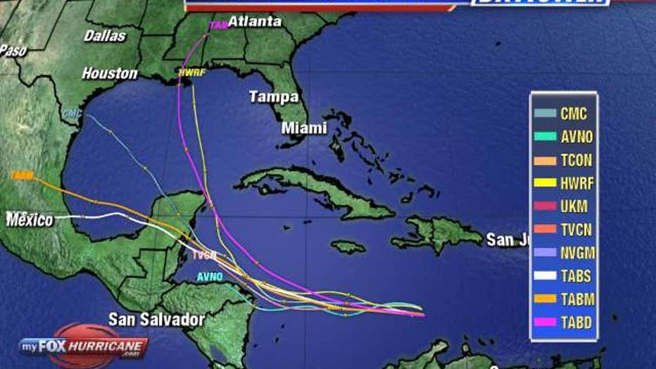
The first area, a tropical wave over the eastern Caribbean Sea, is moving west. Forecasters say it will curve northwestward, and should become a depression late this week or this weekend when it reaches the northwestern Caribbean Sea.

Long-range models bring the system over the Yucatan Peninsula, but its path after that is uncertain.
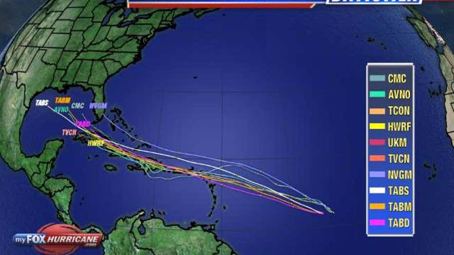
The second tropical wave is the most likely to develop first. The area of low pressure 1,000 miles east of the Windward Islands has a 90-percent chance of forming over the next day as it continues to move west.

Long-range models for that system suggest it will pass over or north of Cuba, possibly heading for the Gulf of Mexico.
"If there are going to be any impacts on the United States from that, it would likely be the mid to later portion of next week," FOX 13 meteorologist Dave Osterberg offered. "We'll just kind of watch and wait and see over the next few days."
The third area of interest is a large area of showers and thunderstorms just coming off of Africa. Forecasters say it has a small chance to organize before conditions get less favorable for development.
LINK: Track the tropics on MyFoxHurricane.com

The next names on the 2020 list are Laura and Marco, should these systems strengthen into tropical storms.

