How will Hurricane Ian impact the Tampa Bay area? Here's a county-by-county breakdown
Hurricane Ian latest forecast shows shift southeast of Tampa Bay
The latest models on Hurricane Ian show the storm shifting drastically southeast of Tampa Bay. Meteorologist Jim Weber says serious flooding is still likely up the west coast of Florida.
TAMPA, Fla. - The Tampa Bay area will begin feeling the impacts of Hurricane Ian as soon as Wednesday when tropical storm-force winds enter the region.
While the cone of uncertainty is getting smaller as the major hurricane begins trekking toward the west coast of Florida, it also means there is less of a chance for much change in the forecast.
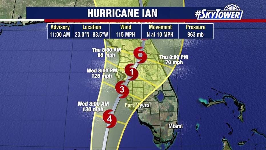
11 a.m. track for Hurricane Ian on Sept. 27, 2022.
Hurricane Ian will encounter wind shear after it leaves Cuba – following its Tuesday morning landfall – and enters the Gulf of Mexico. That will cause it to slow down, which is an issue, explained FOX 13's meteorologist Dave Osterberg.
"That’s going to start to weaken the storm. The storm itself as a response is going to start to slow down and that here-in lies our problems," he said. "As the storm slows down, it gives us a longer duration of rain, longer duration of storm surge, and a longer duration of winds. So the forecast path really hasn't changed."
Tuesday's projected track shows a Category 3 Ian approaching the west coast Wednesday with a potential landfall by 8 p.m. that day somewhere within the forecast cone.
By Thursday at 2 p.m., a weaker Ian will be in northern Central Florida.
Based on the current path, here is what to expect in each Bay Area county. By Friday, Ian is expected to be gone from the Tampa Bay area.
Hillsborough, Pinellas, Sarasota and Manatee
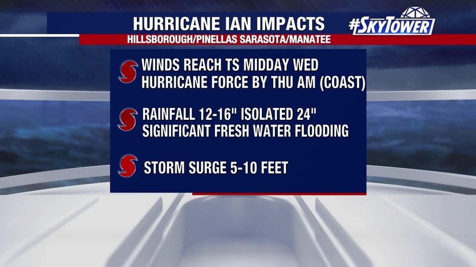
Midday Wednesday, expect wind speeds to reach tropical-storm-force winds. Sarasota and Manatee counties will feel it first as Ian moves south to north. Along the coast, hurricane-force winds will arrive by Thursday morning.
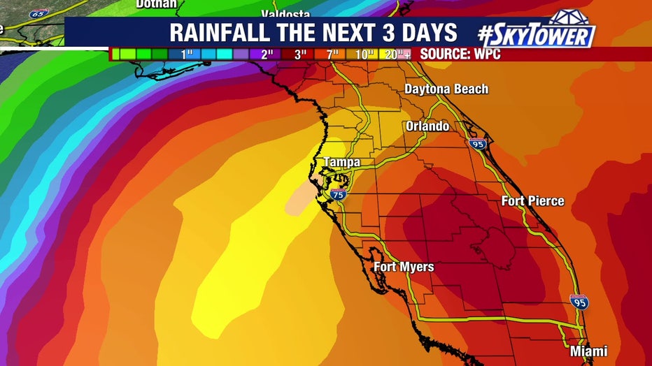
Rainfall totals can reach 12-16 inches, and isolated ares can see 24 inches. This will cause significant freshwater flooding on top of storm surge issues.
Storm surge can reach 5-10 feet.
Check your county's status: County by county: Tropical Storm Ian emergency information
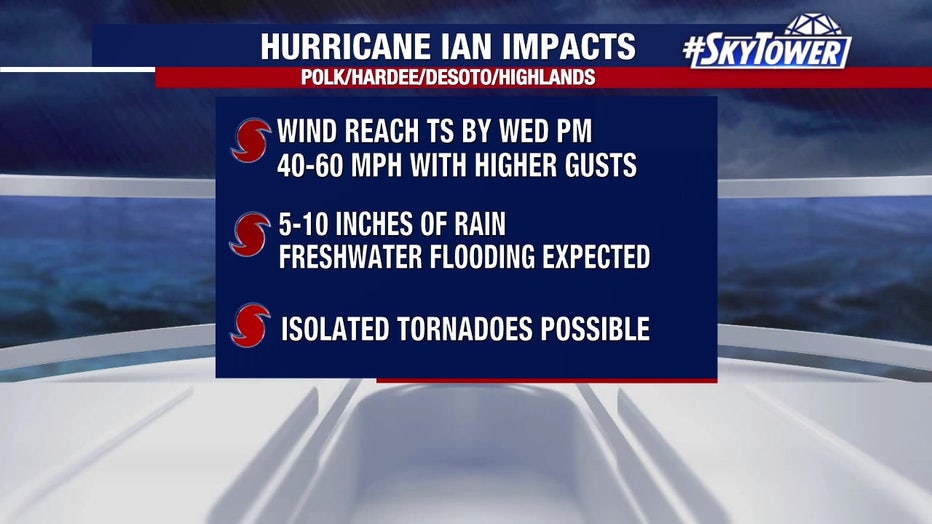
Inland counties: Polk, Hardee, Desoto, and Highlands
Winds reach tropical storm force by Wednesday evening and can reach 40-60 mph.
"It wouldn't surprise me if someone in one of these counties gets a hurricane-force wind gust, but having a sustained hurricane force – unless it takes more of a path to the south – it's kind of tough.
Up to 5-10 inches of rain is possible with freshwater flooding expected. Isolated tornadoes are also possible.
LINK: Track Ian on MyFOXHurricane.com
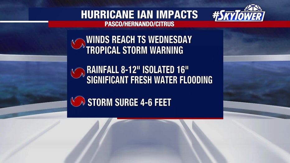
Northern counties: Pasco, Hernando and Citrus
Winds will reach tropical storm force winds by Wednesday afternoon.
Rainfall totals could be 8-12 inches with isolated areas reaching 16 inches. There will also be significant freshwater flooding here.
Storm surge can reach 4-6 feet.
