

Hurricane Ernesto expected to generate dangerous swells, rip currents for U.S. east coast
Dry air limiting Hurricane Ernesto's strength
FOX 13 Meteorologist Jim Weber takes the latest look at Hurricane Ernesto, a Category 1 storm, that might be getting slowed down by dry air in the Atlantic. It is moving towards Bermuda as a still-dangerous storm, but might not reach major hurricane strength.
TAMPA, Fla. - Hurricane Ernesto is continuing to organize as it moves over warm waters in the western Atlantic. It's forecast to become a Category 2 hurricane before barreling through Bermuda.
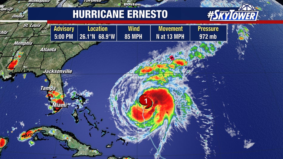
While the storm isn't expected to become a major hurricane, Hurricane Warnings are now in effect for Bermuda. FOX 13 Meteorologist Nash Rhodes said the storm will be battling light to moderate wind shear and dry air that will make it difficult to strengthen too quickly over the next few days.
READ: Volunteers needed for continued support in Sarasota post-Debby
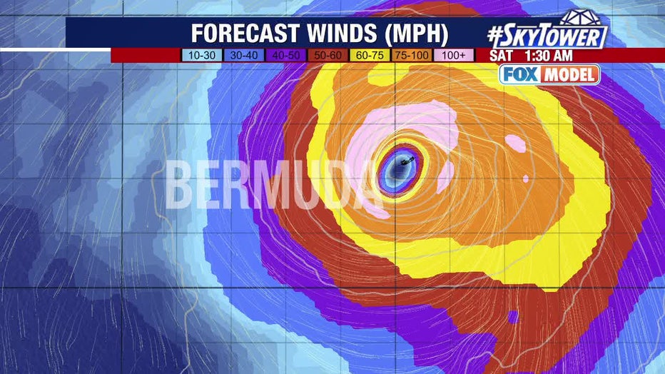
Ernesto should approach the small island of Bermuda late Friday and be near the island Saturday and Saturday night. Rainfall associated with Ernesto could begin to affect Bermuda starting Thursday.
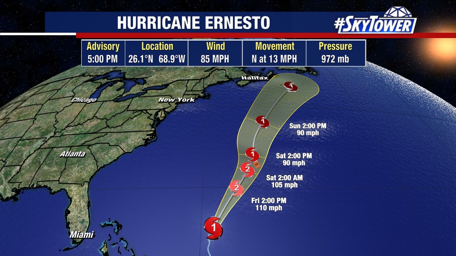
Rhodes said hurricane-force winds, storm surge and inland flooding are are all concerns for the island as Ernesto gets closer.
That's not the only area of impact the NHC advised to be aware of Ernesto, though. Although the hurricane is forecast to remain well offshore the U.S. East Coast, it still could generate swells reaching the area by late this week and into the weekend.
Beachgoers on the U.S. east coast, including Florida, should be aware of the potential for a significant risk of life-threatening surf and rip currents.
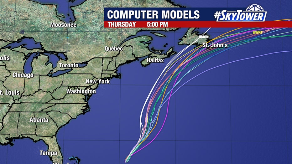
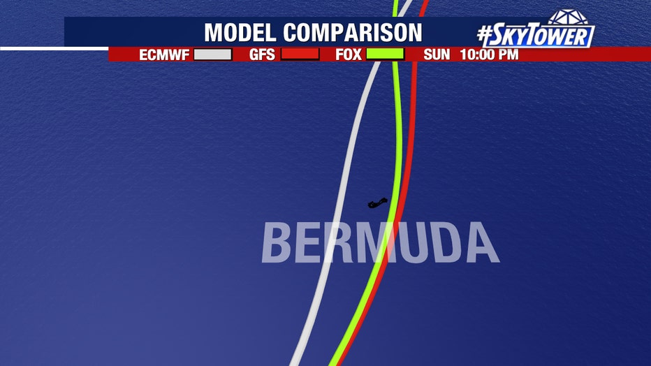
Ultimately, Atlantic Canada could be the next to see impacts from the system heading into next week. There are no other named storms or disturbances being monitored by the NHC currently.
STAY CONNECTED WITH FOX 13 TAMPA:
- Download the FOX Local app for your smart TV
- Download the FOX 13 News app for breaking news alert, latest headlines
- Download the SkyTower Radar app
- Sign up for FOX 13’s daily newsletter