Hurricane Ian becomes category 2, prompts hurricane and storm surge warnings for parts of Tampa Bay area
TAMPA, Fla. - Hurricane Ian is continuing to quickly intensify and has prompted hurricane and storm surge warnings for parts of the Tampa Bay area. The storm strengthened into a category 2 hurricane with winds now up to 105 mph.
It is likely to begin intensifying again after the storm passes over Cuba.
Ian formed into a hurricane early Monday morning and began rapidly strengthening as it moved over the Caribbean Sea and Cuba. Much of Florida remains in the forecast cone, with the storm tracking closer to Tampa Bay as forecasting becomes clearer.
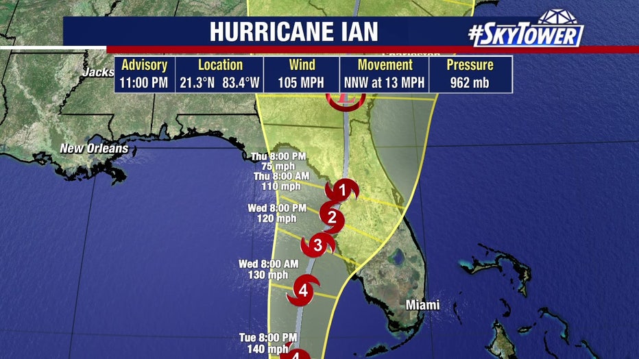
The National Hurricane Center said life-threatening storm surge is possible along most of Florida's west coast, with the highest risk being between Fort Myers and the Tampa Bay area.
Evacuation orders were already being issued for those in low-lying areas.
Check your county's status: County by county: Tropical Storm Ian emergency information
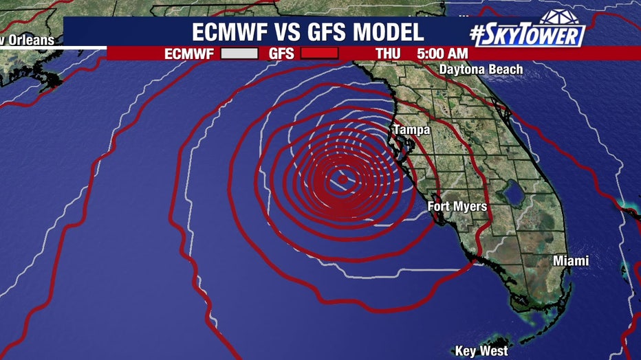
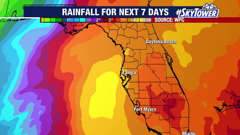
Heavy rainfall is expected to begin Tuesday over the Florida Keys and then track north along the coast.
NHC said significant, prolonged river flooding is likely across central Florida, as well.
A Hurricane Watch has been issued for the west coast of Florida – from north of Englewood to the Anclote River, including Tampa Bay.
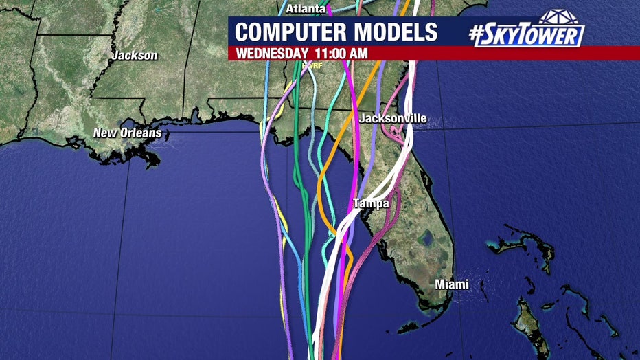
A Storm Surge Watch is in effect for Pinellas County and coastal areas of Hillsborough, Manatee and Sarasota counties.
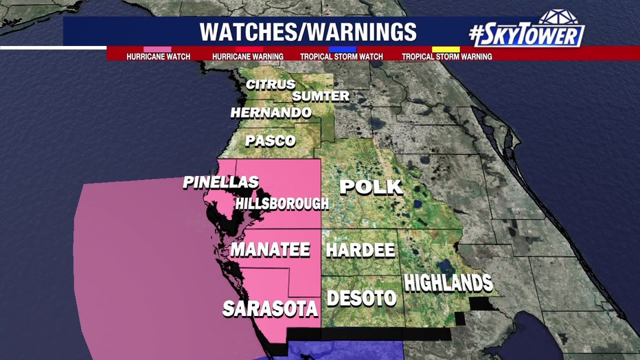
Can Hurricane Ian's track still shift?
Monday morning, meteorologists said the chances of Hurricane Ian not impacting our area are "running out."
With the NHC's 11 a.m. update confirming previous updates, the chances moved even lower.
"In the short-term forecast, there have been very few times, especially in the past decade or so, that in a 24-hour and 36-hour forecast the cone has been wrong, which is literally going to put this as a Category 3 or 4 storm, somewhere west of the Keys," Osterberg explained.
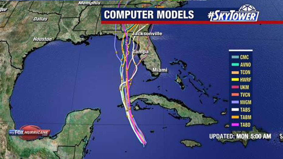
The closer it comes to Florida's west coast, the more residents will have to deal with wind speeds.
"I do think most of the areas are going to get tropical-storm-force winds," Osterberg said. "Who knows? Maybe the track does shift, but at this point, the models are really converging on the west coast of Florida, in general."
"There is a track error that could be 75-100 miles. So again, 75-100 miles of either side of that line makes a huge difference in the forecast for us," Osterberg said. "But it still means impacts – the question we can’t answer is just how much yet."
How will the Tampa Bay area be impacted, based on the current track?
Residents should prepare for storm surge and major flooding.
"It doesn't matter whether it even takes that eastern path or that western path, we’re still going to have that storm surge kind of riding up, and you know how vulnerable the west coast of Florida is to storm surge," Osterberg explained.
The storm is predicted to slow as it moves over the Gulf of Mexico, creating further problems for floodprone areas.
"Unlike other storms that have come through -- Wilma, Charley, namely -- they came racing across the state," Osterberg added. "This one is not going to do that. Even if it’s just tropical storm force winds, we’re going to be subjected to these for a day and a half or two days. Not just a few hours. You’re going to be subjected to this south wind pushing the water up Bayshore for a couple of days, not just a few hours."
Between Tuesday afternoon and Wednesday afternoon, the forecast shows Ian southwest of Tampa Bay.
"It’s going to take, what, 36 hours, and then moving north, another 18? I mean, folks, what I'm trying to tell you is that we're going to have multiple high tides with storm surge," Osterberg said. "We're going to have lots and lots of rain because we're going to continue to pull in with that south wind, all of that moisture."
He pointed out that while it may look beneficial to see Ian might weaken as it approaches the coast – but there is a potential downside.
"When the storm starts to weaken like that, the wind field will expand. So, while the winds are dropping, you’re still getting damaging winds much further out," Osterberg explained.
The exact track will dictate where the strongest storm surge and strongest winds will occur.
"It’s going to be raining heavily. The water is not going to readily wash back out into the bay. Why? Because of that south wind," Osterberg said. "Remember with Irma, it went to our east, and we had that north wind that drove water out of the bay? Well, now the storm is passing to our west, it’s a south wind, so that pours all the water into the bay. The water sitting up in the bay is going nowhere, and it’s raining and the rain can’t drain out."
Where is Hurricane Ian?
Ian is expected to move through western Cuba by Monday night through Tuesday morning. Ian will then emerge over the southeastern Gulf of Mexico on Tuesday, and pass west of the Florida Keys later that day, according to the National Hurricane Center. It will approach the west coast of Florida on Wednesday.
LINK: Track Ian on MyFOXHurricane.com
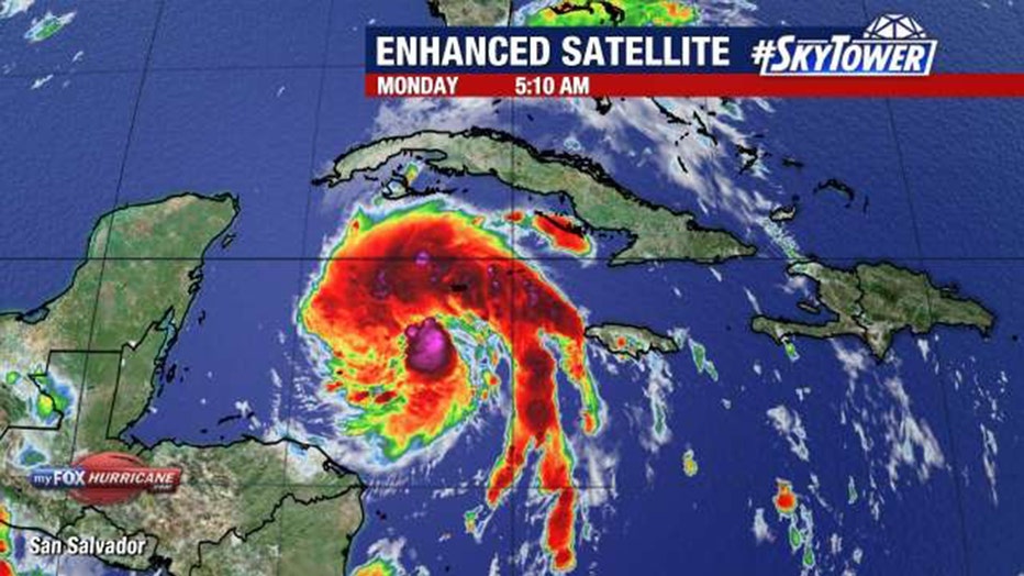
The NHC predicts Ian will reach major hurricane strength Tuesday. Flash and urban flooding is possible in the Florida Keys and Florida peninsula through midweek, and then heavy rainfall was possible for north Florida, the Florida panhandle and the southeast United States later this week.
As of Monday morning, Hurricane Ian was in the Caribbean Sea and centered about 160 miles south of Grand Cayman in the Cayman Islands and more than 430 miles away from the western tip of Cuba.
Ian had maximum sustained winds of about 60 mph and was moving northwest at 12 mph. Forecasters noted that satellite images revealed a flare-up of convection around Ian's center, meaning it is showing signs of rapid intensification.

