

Tropical wave brewing in Atlantic may be hindered by Saharan dust
Tropical wave may develop over next week
FOX 13 Meteorologist Nash Rhodes is keeping an eye on a tropical wave that has a 60% chance of developing over the next week. Rhodes says some models keep the storm gaining strength and staying off the east coast of the United States, if it does develop. Rhodes says Saharan dust still blankets the area, making it difficult for the system to get the tropical moisture around it that it would need to organize and find its footing in the middle of the Atlantic. If the storm does earn a name, it will be called Ernesto. He is also watching what’s left of Debby, which is now a post-tropical cyclone, as it races over the northeast at 37 miles an hour, dumping heavy rain on the area.
TAMPA, Fla. - As Debby races through the northeast as a post-tropical cyclone, meteorologists already have their eye on another tropical disturbance.
A tropical wave was located several hundred miles to the west-southwest of the Cabo Verde Islands on Friday morning. It is causing a large area of disorganized showers and thunderstorms over the tropical Atlantic.
The system, which has a 60 % chance of developing within the next seven days, is expected to move west-northwest and could approach the Greater Antilles by the middle of next week.
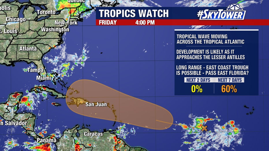
FOX 13 Meteorologist Nash Rhodes says it is unclear where the storm will go from there.
READ: 'It's overwhelming:' Sarasota County residents get first look at flooded homes after Debby
He noted that some models show it moving to the north while others take it toward the west. Rhodes says that’s due to the steering pattern that’s going to set up as he looks at the high-pressure system that’s going to set up to the north of the tropical system by Tuesday.
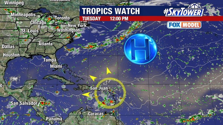
If that high-pressure system slides off to the east, the tropical system would be able to lift to the north and likely stay east of the United States. If that happens, Rhodes cautions that the system would be stronger and would pull to the north faster than models that show the storm being weaker.
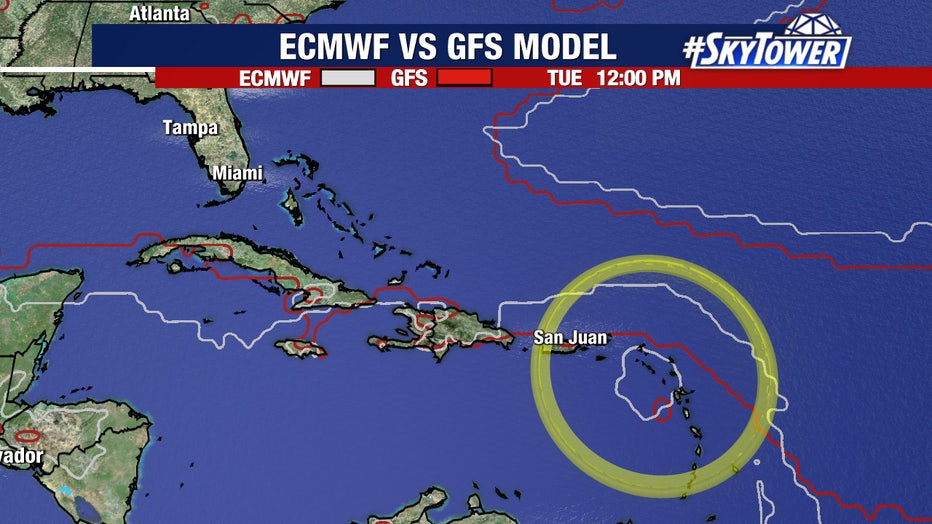
According to Rhodes, a weaker system with a strong area of high pressure to the north would send the system off to the west.
READ: Florida rescue team saves American flag as Debby roars by coastline
Rhodes says Saharan dust still blankets the area, making it difficult for the system to get the tropical moisture around it that it would need to organize and find its footing in the middle of the Atlantic.
If the storm develops and earns a name, it will be called Ernesto.
SIGN UP: Click here to sign up for the FOX 13 daily newsletter