New disturbance could fuel tropical activity from Caribbean, Gulf of Mexico
Area of low pressure over Central America
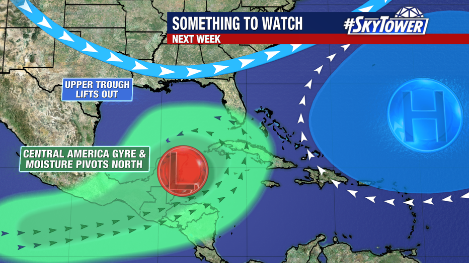
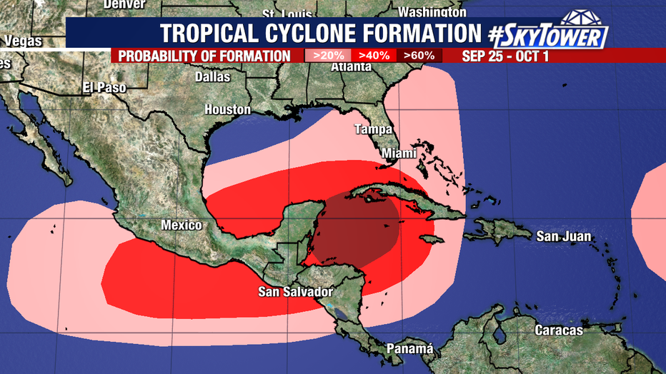
FOX 13 News Meteorologist Jim Weber says an area of low pressure called the Central America Gyre could help tropical cyclones form. According to Weber, there's a possibility that there could be development next week.
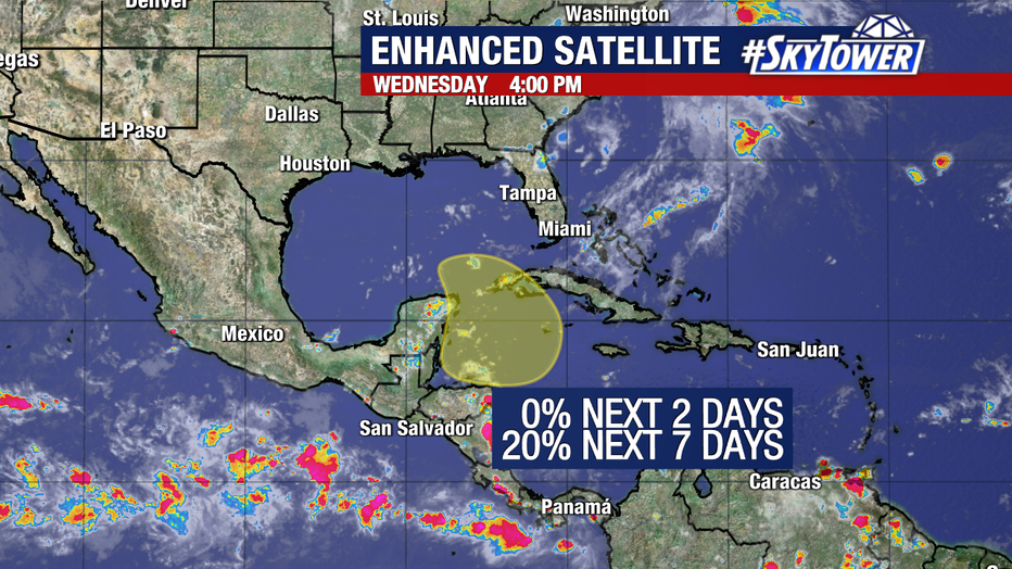
TAMPA, Fla. - The National Hurricane Center has started monitoring a broad area of low pressure that could form in the northwestern Caribbean Sea.

According to the NHC, the low-pressure area could form late this weekend or early next week.
READ: Mother of teen killed in Citrus Park mall shooting looking for answers: 'He didn't deserve this'
Some slow development is possible through the middle of next week while it moves slowly to the north or northwest over the northwestern Caribbean Sea or the southeastern Gulf of Mexico.

The NHC gives the disturbance a near-zero chance of development over the next two days and a 20 percent chance of development over the next week.
STAY CONNECTED WITH FOX 13 TAMPA:
- Download the FOX Local app for your smart TV
- Download the FOX 13 News app for breaking news alerts, latest headlines
- Download the SkyTower Radar app
- Sign up for FOX 13’s daily newsletter
FOX 13 Meteorologist Dave Osterberg said in early fall, this area of low pressure called the Central America Gyre forms in the western Caribbean Sea and historically fuels tropical activity.

Based on the way the atmosphere is set up, it would likely get pulled up into the Gulf," Osterberg said. "That's all the information that we have. That's all the information that anyone has right now."

