Pacific’s Hurricane Agatha's remnants could bring plenty of rain to Florida this weekend
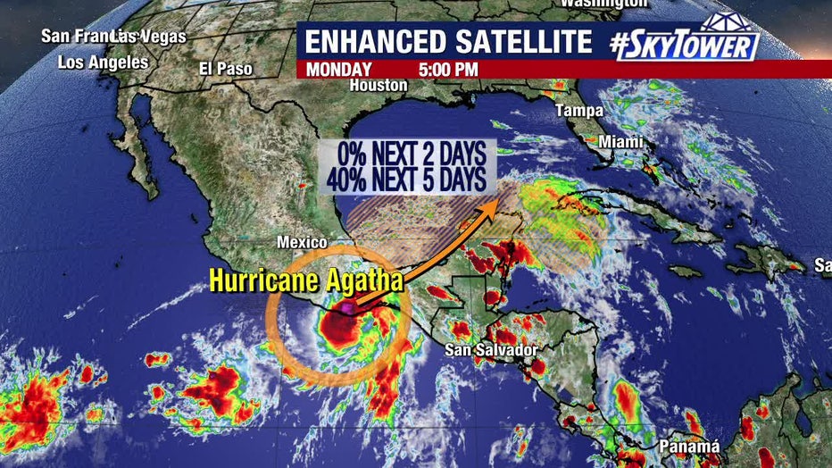
TAMPA, Fla. - While the Atlantic hurricane season hasn't officially started yet, Hurricane Agatha over in the Pacific Ocean could increase rain chances in Florida this weekend. But first, it would need to make its way over Mexico's rough terrain, where it will likely be "torn apart," says FOX 13's meteorologist Dave Osterberg.
After that, its leftovers could bring plenty of tropical moisture to at least South Florida this weekend.

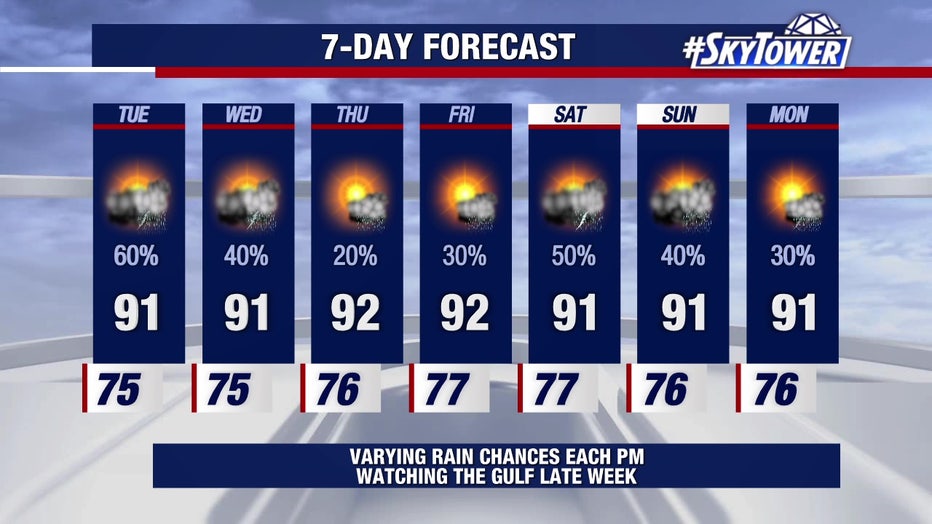
"Long-term we’re going to watch all this deep tropical moisture work its way toward at least South Florida – may be as high as Central Florida this weekend," Osterberg explained. "I think in general with some southwesterly winds, it’s just going to be a big mess. But that big mess is going to enhance our rain chances next weekend – "could" being the key term. It’s only Monday."
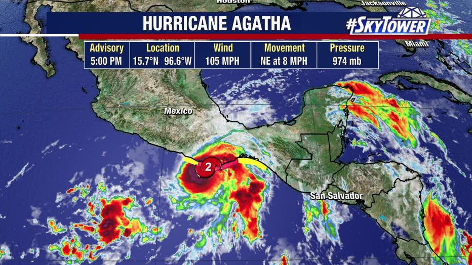
Agatha, which is a Category 2 hurricane, made landfall in southern Mexico Monday afternoon.
"Rapid weakening is expected after landfall, and Agatha is forecast to dissipate over southeastern Mexico by late Tuesday," according to the National Hurricane Center.
LINK: Track the tropics on MyFOXHurricane.com
Osterberg described Agatha as a strong storm this early in the Pacific hurricane season – which started May 15. But that strength won't last long.
"It doesn’t have far to go to becoming a major hurricane, and it’s going to make its way onshore to mainland Mexico. This is a very mountainous area, just north of Central America," he explained. "It will likely begin to just kind of tear this storm apart – which is good, right? But then, what’s left of it reemerges back out either in the Caribbean or in the Bay of Campeche, southwest Gulf of Mexico."

Then, all that moisture will work its way northeastward. The two computer models meteorologists describe as reliable during the hurricane season are currently disagreeing on where Agatha's remnants will travel.
"Shocker," Osterberg said. "We’re just going to have to wait until it gets closer to the weekend."
READ: For first time since 2014, Atlantic hurricane season may not start early
One computer model brings the tropical moisture up to Central and South Florida. The other shows it remaining in South Florida.
"Two different scenarios, a lot of time to watch. It’s all going to depend on how much and where of what’s left of Agatha kind of redevelops and moves back out over the water," Osterberg said. "But first, it’s going to make its landfall there in western Mexico."

But, if it does redevelop into a named storm, will it take on the first name of the Atlantic hurricane season? Or is it still Agatha?
"The answer is – it depends. If the core structure of the storm is still there. It would stay Agatha. I don’t think that’s going to happen," Osterberg said. "I think what you’re going to see is tropical moisture strewn all over the place. And the remnants could redevelop. Then, it would be Alex."

