

Tracking the Tropics: Disturbance sees increased chance of development near Florida
Previous: Tropical system to bring rain to Florida
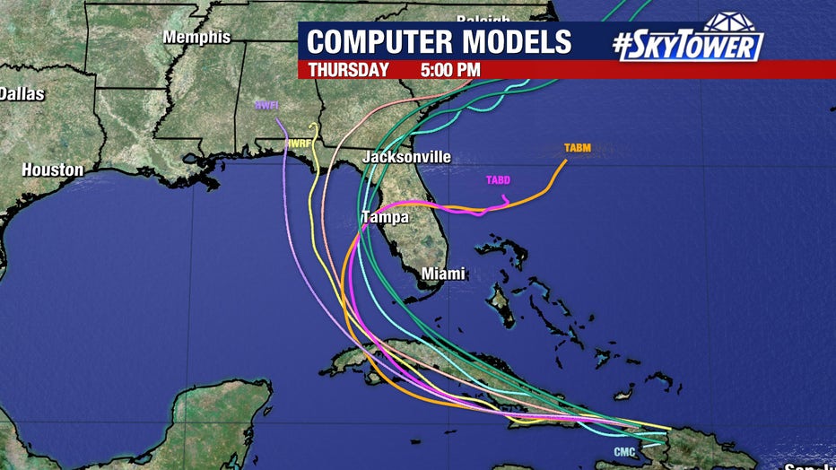
FOX 13 Meteorologist Nash Rhodes is continuing to monitor a tropical system that has been upgraded to Invest 97L. Nash notes that it is too early to pinpoint where the rain will fall because the system could strengthen or weaken, and its path is not set in stone. If the storm earns a name, it will be called Debby.
TAMPA, Fla. - A tropical wave rolling through the Atlantic has an increased chance of development as it approaches Florida in the coming days.
According to the National Hurricane Center, the tropical disturbance could develop into a tropical depression over the eastern Gulf of Mexico or far southwestern Atlantic Ocean in the vicinity of Florida by the weekend.
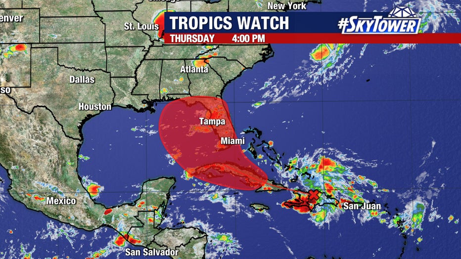
FOX 13 Meteorologist Nash Rhodes said it is too early to accurately predict the exact intensity and track of this system. This disturbance’s interaction with Cuba’s terrain will have big implications on its ultimate path and strength.
READ: Tampa Bay Rays, City of St. Pete sign deal to build new ballpark, keeping team in town for 30 years
It's currently producing a large area of disorganized showers and thunderstorms over Puerto Rico, the Virgin Islands, and the northern Leeward Islands.
The NHC gives the disturbance a 30 percent chance of development over the next two days and a 70 percent chance of developing through the next week.
Environmental conditions are forecast to become more conducive for development after the wave passes the Greater Antilles.
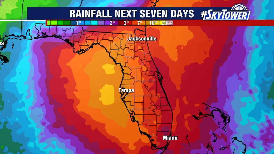
Rhodes said Florida residents should be monitoring the progress of this system over the next few days. It does have the potential to bring a lot of rainfall to end the weekend and begin the following work week.
Rain estimates expected from the system will likely change and shift around as models come to a consensus on Invest 97L's track.
SIGN UP: Click here to sign up for the FOX 13 daily newsletter