

Tracking the Tropics: New disturbance pops up off east coast of Florida

NHC monitoring one disturbance and plumes of Saharan dust
FOX 13 meteorologist Jim Weber is tracking the tropics.
TAMPA, Fla. - Following a busy start to the Atlantic hurricane season, we’re now only experiencing limited activity in the tropics. We are only monitoring a broad area of low pressure off the southeastern United States coast with slim odds of formation over the next week.
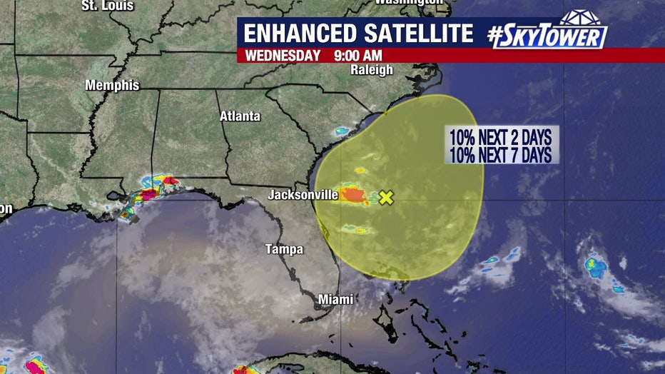
Conditions are only marginally favorable for development as this disturbance moves over the Southeastern United States by this weekend. Ample amounts of shear and dry air will be the primary obstacles to this organizing into a tropical depression or tropical storm. The majority of our weather models do not support the development of this system.
READ: Woman arrested after admitting to making online death threats against Gov. DeSantis: HCSO
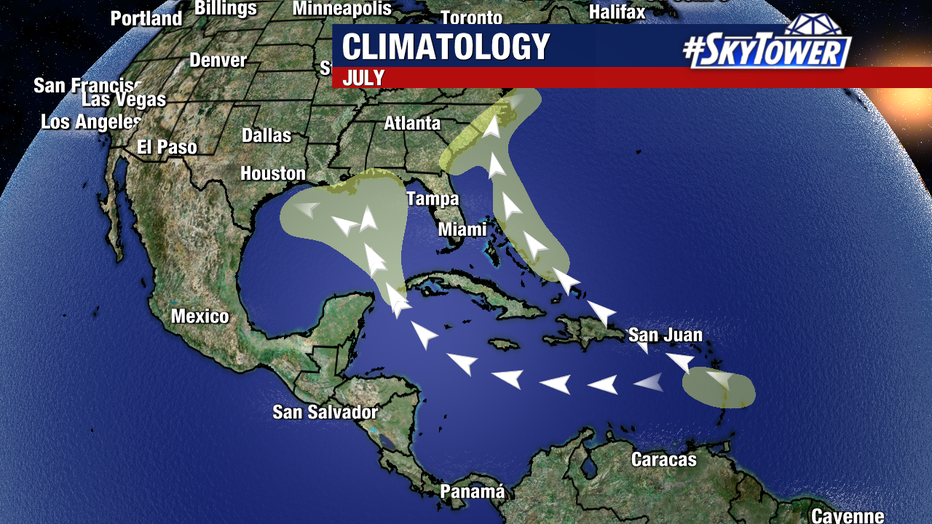
Climatologically, this is a region where we would typically see tropical development in July.
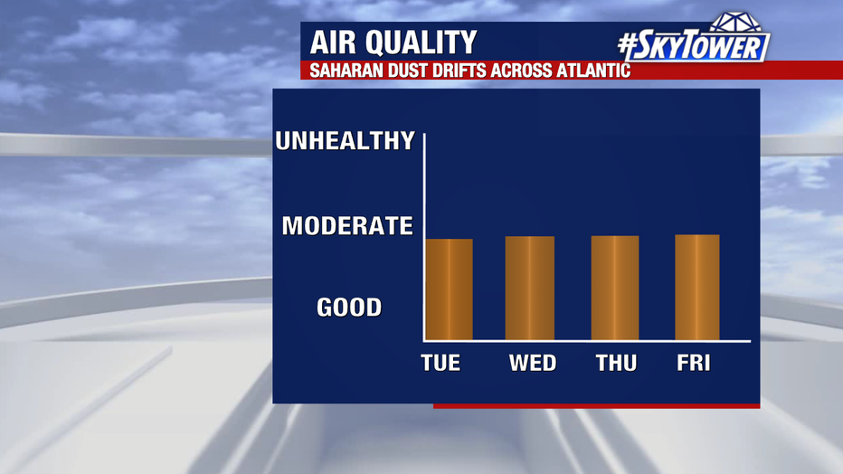
Saharan dust continues to blanket a notable amount of the Atlantic, including the Gulf of Mexico and the Caribbean Sea. This will likely continue to tamper tropical activity over the next week.
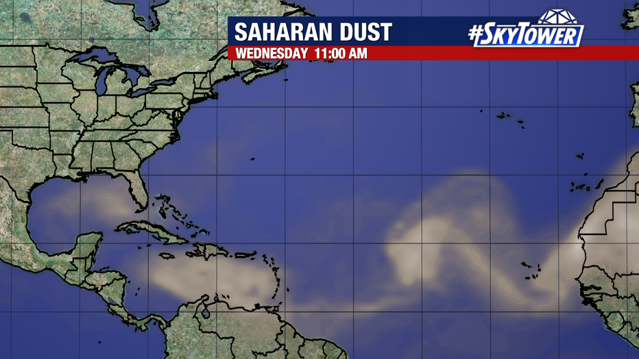
Central Florida will continue to see a slight haze in the sky and small drops in air quality over the next couple of days thanks to this Saharan dust. Allergies and respiratory issues may be aggravated during this period. These dust plumes can also create vibrant sunrises and sunsets, with more of a glow than we would typically see in the evening.
SIGN UP: Click here to sign up for the FOX 13 daily newsletter