Tropical Storm Ian forms in Central Caribbean Sea, Florida remains in cone of uncertainty

Tropical Storm Ian forms
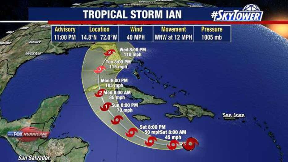
Tropical Storm Ian has formed in the Central Caribbean Sea late Friday evening and is projected to continue strengthening. Florida remains in the cone of uncertainty as of the 11 p.m. advisory on the storm.
TAMPA, Fla. - Tropical Storm Ian has formed in the Central Caribbean Sea late Friday evening and is projected to continue strengthening. Florida remains in the cone of uncertainty as of the 11 p.m. advisory on the storm.
As of the 11 p.m. advisory, Tropical Storm Ian was moving west northwest 12 miles per hour with winds of 40 miles per hour. The system was originally Tropical Depression 9 that formed early Friday morning in the eastern Caribbean Sea.
The system is still battling a bit of northeasterly wind shear, but it'll be moving into an environment much more conducive for organization this weekend. Hurricane conditions are possible in the Caymen Islands early Monday, according to the National Hurricane Center.

LINK: Track the tropics on MyFOXHurricane.com
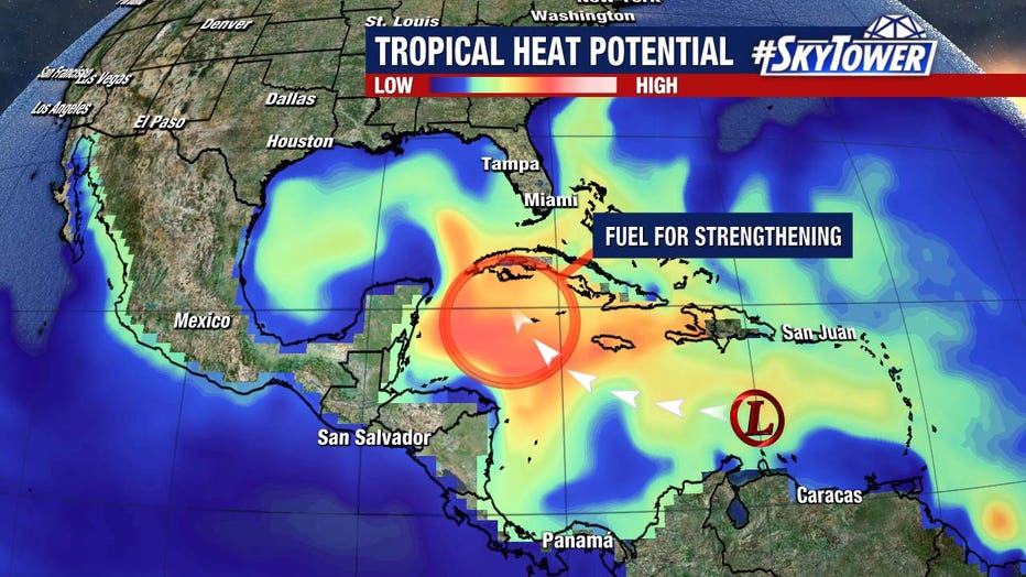
As this moves further to the west, it reaches an area with enormous tropical heat potential. Very deep, warm water will undoubtedly lead to strengthening.
LINKS:
- New to Florida? Here’s a guide to help prepare for your first hurricane season
- 2022 storm prep & shopping list (PDF)
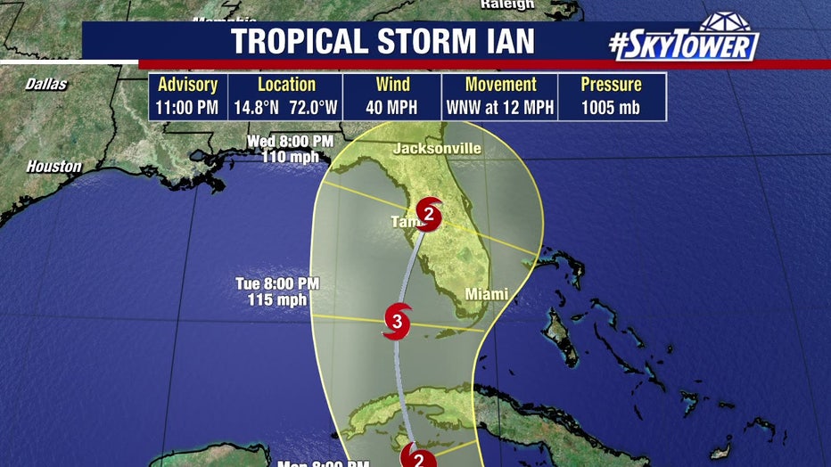
In all likelihood the system may become a hurricane late Sunday or early Monday south of Cuba. It's expected to approach Florida Tuesday into Wednesday. It's not out of the question that this becomes a major hurricane during that time.

FOX 13 Meteorologist Tyler Eliasen said, although we've been able to narrow the storm's track down to a general path toward Florida, it's important to remember the cone is still very wide at day five (about 400 miles away). A track up the left-hand side of the cone versus the right-hand side means drastically different impacts for any given location.
While it is still too early to nail down the specific timing/location of impacts, residents anywhere along the Florida peninsula need to be in the early stages of their preparations.

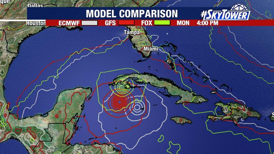
Afternoon model guidance is still a bit split beyond the next two to three days. The latest Euro hints at a Southwest Florida landfall while the GFS is further north into the Big Bend. Again, these are two drastically different outcomes when it comes to impacts.
As data collection continues and the storm develops a bit more, models will come into better agreement. So, just as we know a lot more now than we did yesterday or the day before, we’ll know a lot more over the weekend.

Most of Florida is currently in the cone of uncertainty, though meteorologists warn that a lot could change over the next several days.
"This is the initial forecast path, and I want to stress 'initial' because I promise you that this is going to change a little bit," FOX 13 Meteorologist DaveOsterberg said. "Is it going to change to the western Gulf? No, I don't think so. But if it tweaks a little west or tweaks a little east, makes a big difference in the potential impact it could have around here."

