Potential Tropical Cyclone One timing, impact: Heavy rain expected around Tampa Bay starting Friday
TAMPA, Fla. - One day into the 2022 Atlantic Hurricane season, Floridians in the Tampa Bay Area are already preparing for a tropical system to dump heavy rains and possibly cause localized flooding.
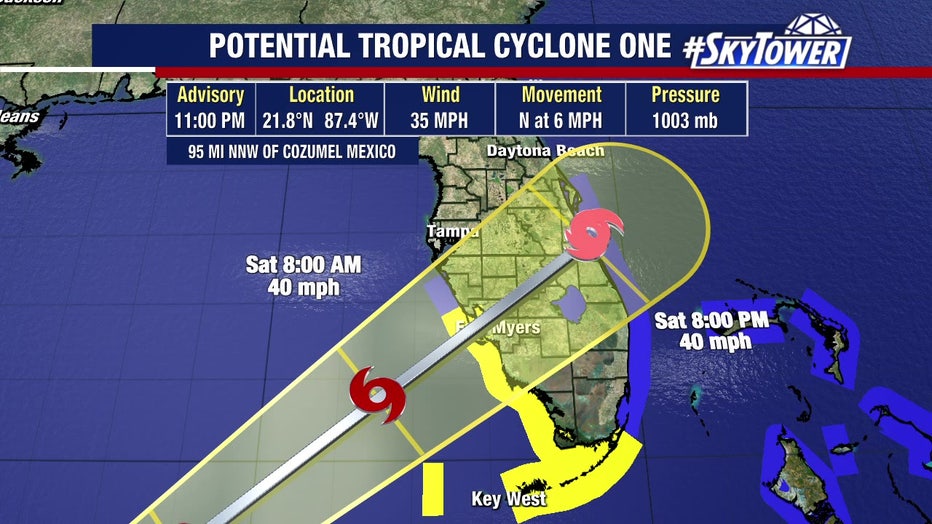
In general, residents from Sarasota and Highlands counties to Hillsborough and Polk counties will see most of the rain and some gusty winds beginning early Friday evening into Saturday.
FOX 13 Meteorologist Jim Weber says there’s a 90% chance for the tropical disturbance, Potential Tropical Cyclone One, to turn into a tropical depression or storm.
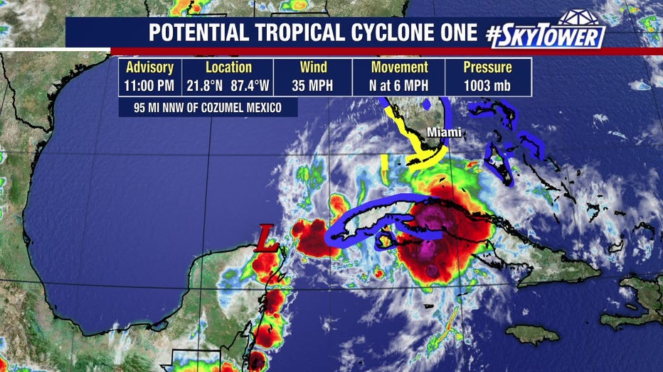
If the disturbance becomes a tropical storm, it will be called Alex, the first name on this season’s list from the World Meteorological Organization.
Preparation is key: 2022 Atlantic hurricane season is officially here
The path and strength of the disturbance became clearer in the National Hurricane Center's 11 p.m. update Thursday, showing movement north toward the I-4 corridor as the storm crosses the state Friday and Saturday.
Timing – South Florida:
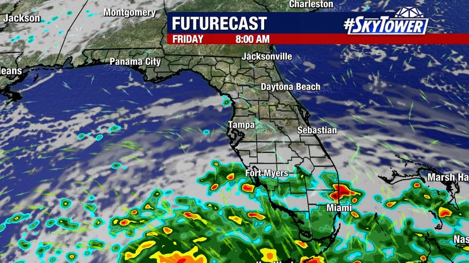
FOX 13 Weather Center Futurecast of Potential Tropical Cyclone One - Friday 8 a.m. prediction as of 5 p.m. Thursday
Timing for the Tampa Bay Area is still forming as Potential Tropical Cyclone One makes its way across the Caribbean, but it appears the heaviest rain will occur south of the I-4 corridor.
In South Florida, Tropical rains are predicted to arrive Thursday night ahead of the system, and heavier rain is predicted on Friday starting before 9 a.m.
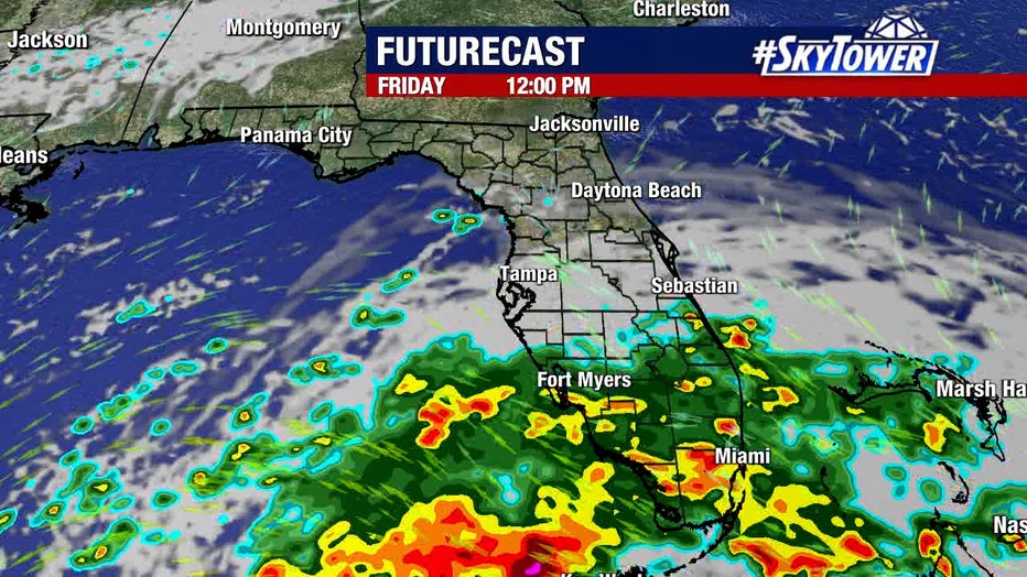
FOX 13 Weather Center Futurecast of Potential Tropical Cyclone One - Friday 12 p.m. noon prediction, as of 5 p.m. Thursday
Here are the names you'll see during the 2022 Atlantic hurricane season
South Florida grounds are already saturated from days of heavy rain, so flooding is possible.
Check myfoxhurricane.com for flood alerts issued by the National Weather Service.
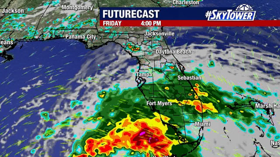
FOX 13 Weather Center Futurecast of Potential Tropical Cyclone One - Friday 4 p.m. prediction as of 5 p.m. Thursday
Wind gusts of 40-plus miles per hour are also likely across South Florida. Some fast-developing tornadoes could occur as well.
Winds might still be gusty in South Florida on Saturday, but rain may not be as heavy.
Timing – Tampa Bay:
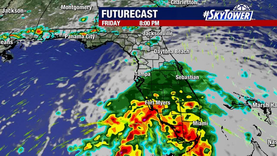
FOX 13 Weather Center Futurecast of Potential Tropical Cyclone One - Friday 8 p.m. prediction as of 5 p.m. Thursday
Around Tampa Bay, pockets of heavy rain are expected Friday starting around dinnertime, with the chance for localized flooding along the coast of Sarasota, Manatee, and Pinellas counties, and in low-lying areas later Friday into early Saturday morning.
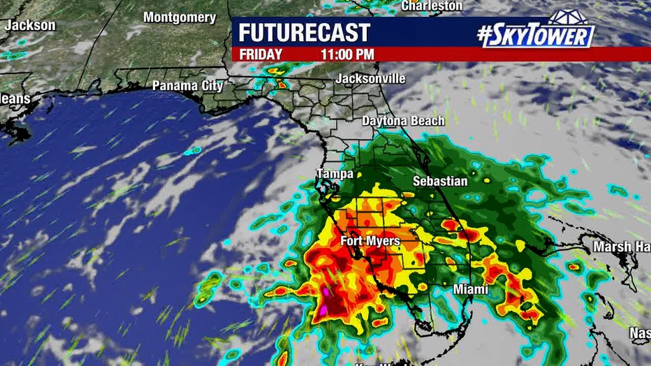
FOX 13 Weather Center Futurecast of Potential Tropical Cyclone One - Friday 11 p.m. prediction as of 5 p.m. Thursday
As of Thursday evening, models showed the system staying to the south of upper Hillsborough and counties north and west.
However, the latest models of the storm's potential path pushed heavy rain predictions across Polk, Hardee, Desoto, and Highlands counties early Friday evening into Friday night.
1 out of 4 Floridians would ignore hurricane evacuation warnings, survey says
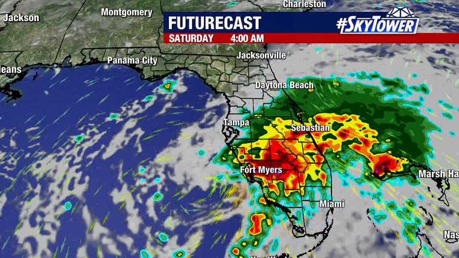
FOX 13 Weather Center Futurecast of Potential Tropical Cyclone One - Saturday 4 a.m. prediction as of 5 p.m. Thursday
Rain chances across the Bay Area Saturday were 60%, however, counties inland may experience soaking rains early Saturday morning.
The National Hurricane Center will issue Tropical Storm Watches or Warnings if the disturbance strengthens or its track moves.
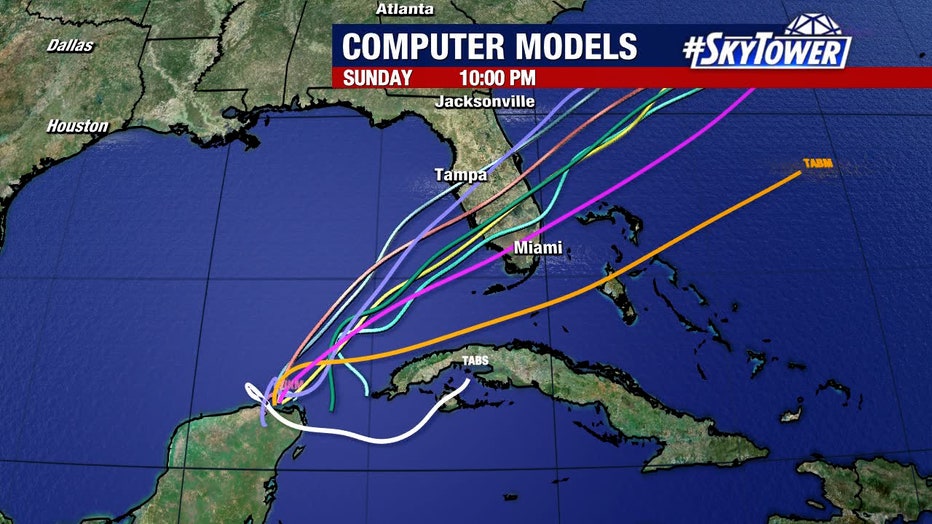
Computer models for Potential Tropical Cyclone One, as of 5 p.m. Thursday

