Tropical Storm Fiona: Long-range forecast keeps it east of Florida for now, still worth monitoring
Today's tropical weather forecast
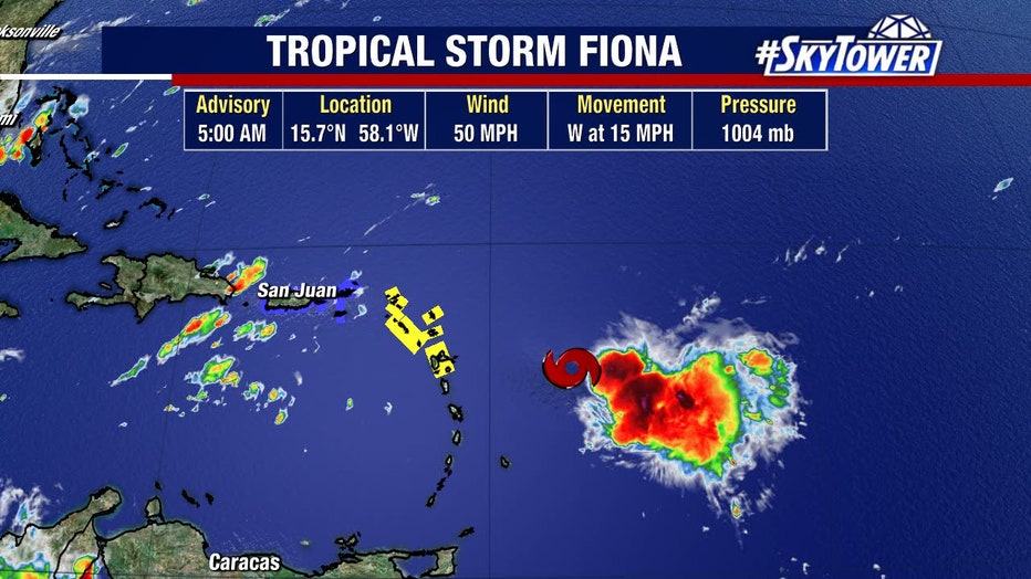
Meteorologist Jim Weber says Tropical Storm Fiona is nearing the northern Leeward Islands. As it works its way through the Caribbean, it could have an opportunity to strengthen. One of the big questions is when it may turn north. Computer models are starting to agree, showing it may completely avoid Florida.
TAMPA, Fla. - While Tropical Storm Fiona is not an immediate concern for Florida, long-range computer models show it turning north and avoiding the Sunshine State – but forecasters said it's still worth keeping an eye on next week.
Friday, the disorganized storm inched closer to the Leeward Islands.
LINK: Track Tropical Storm Fiona on MyFOXHurricane.com
"It looks ragged this morning, which is a good thing," explained FOX 13's meteorologist Dave Osterberg. "It doesn’t really look like a tropical storm, to be honest with you. It’s a little bit further south now, so they’re going to drift it and work its way through the northern Leeward Islands."
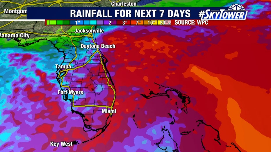
An area of wind shear has been discouraging Fiona from strengthening, but that could change when it reaches the warmer waters of the Caribbean Sea. Either way, rain impacts are expected to spread from the northeastern Caribbean islands westward through Puerto Rico and Hispañiola through Sunday. It's not expected to be a huge wind maker for the islands, Osterberg said.
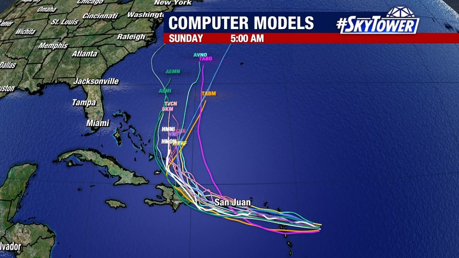
"Computer models are all in agreement in the short-term, right through this weekend that whatever form this is, it’s going to work its way just south of San Juan, work it up through the Dominican Republic," he said. "Now, on a track like this, you’re going to pour so much rain into Puerto Rico and the Dominican Republic that there will be no doubt be some flash flooding and the potential for mudslides."
From there, computer models show it turning north, moving parallel to Florida, then heading east.
"Is this 100%? No," Osterberg offered. "I don’t trust any storm until it’s past our latitude. The computer models are coming together in the long-term to keep it east of our state."