Warnings issued for Panhandle as Fred restrengthens to tropical storm
Tropical weather forecast Sunday night update
Meteorologist Tyler Eliasen gives an update on Fred, Tropical Depression Grace, and soon-to-form Henry out in the Atlantic.
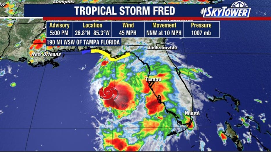
TAMPA, Fla. - Fred restrengthened into a tropical storm in the Gulf of Mexico Sunday morning, bypassing the Bay Area en route to a landfall near the Alabama-Florida border.
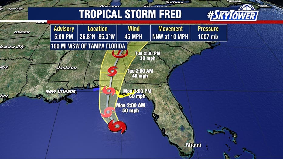
Sunday evening, the storm had winds of 45 mph was about 190 miles west-southwest of Tampa, moving north-northwest at 10 mph. Earlier, an Air Force Reserve Hurricane Hunter plane found a closed center of circulation, prompting tropical storm warnings for the northern Gulf Coast.
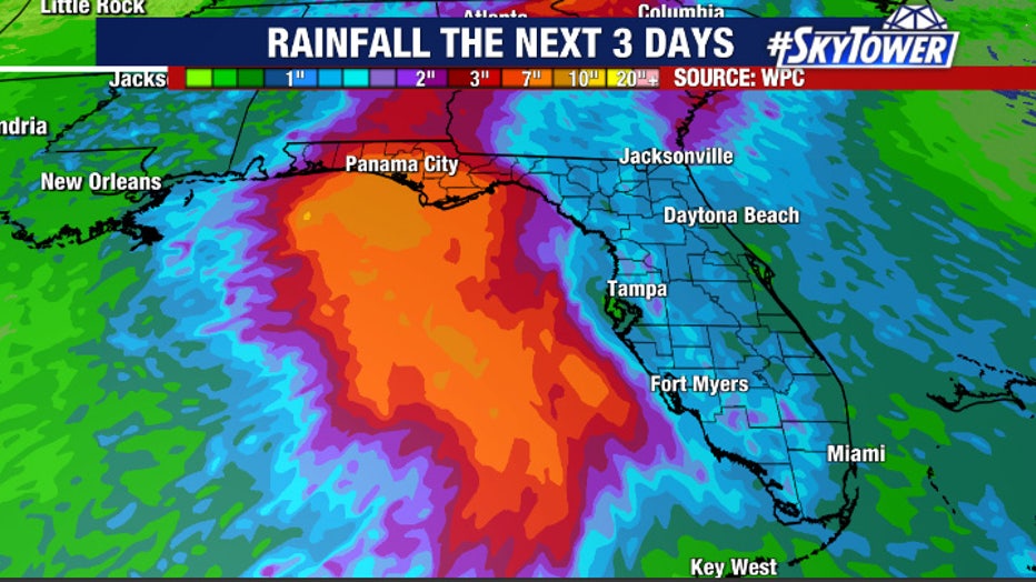
The heaviest wind and rain should remain offshore from Tampa Bay as Fred – regardless of its storm status – moves north past the state’s west coast.

"When Fred makes its closest pass, we'll start to increasing rain chances. I think that will happen as we push towards later this evening. Much of the action is going to be along the coast," FOX 13 meteorologist Tony Sadiku offered.
LINK: Track Fred on MyFoxHurricane.com

There’s also a marginal risk for severe weather, especially west of I-75.
"As we typically see on the east side of a storm, we could see a couple of rotating storms – waterspout or tornado – not impossible, but it's not likely," Sadiku continued.
Fred is now expected to make landfall in the western Florida Panhandle sometime Monday afternoon or evening.

A tropical storm warning is in effect for the coast of the Florida Panhandle from Navarre to the Wakulla-Jefferson County line.
A tropical storm watch is in effect for the coast of the Florida Panhandle from the Alabama-Florida border to Navarre.
A storm surge warning is now in effect for the coast of the Florida Panhandle from Indian Pass to Yankeetown.
LINK: Track Fred on MyFoxHurricane.com
Meanwhile, forecasters were also watching Tropical Storm Grace, which remained disorganized Sunday but was expected to eventually enter the Gulf of Mexico.

