

Helene to rapidly intensify over Gulf of Mexico, portions of Florida under hurricane warning
TAMPA, Fla. - Tropical Storm Helene is expected to rapidly intensify as it gets into the Gulf of Mexico. As the system works its way toward Florida, portions of the Sunshine State are under a hurricane warning.
Helene is expected to become a hurricane Wednesday and could upgrade into a major Category 3 storm by the time it makes landfall in Florida's Big Bend region.
As of 11 p.m., Helene was located 19.9 N and 85.5 W. and had maximum sustained winds of 60 miles an hour and was moving west-northwest at 10 miles an hour.

The National Hurricane Center said the storm is also expected to grow in size as it intensifies in the gulf. FOX 13 Meteorologist Nash Rhodes said Helene will be a large storm with wide-reaching impacts across all of Central Florida – despite the Tampa Bay area being outside the forecast cone.
Storm watches and warnings
A hurricane warning has been issued from Anclote River to Mexico Beach.
Tropical Storm Helene: County-by-county guide
A tropical storm warning has been issued for the Middle Florida Keys from the Seven Mile Bridge to the Channel 5 Bridge.
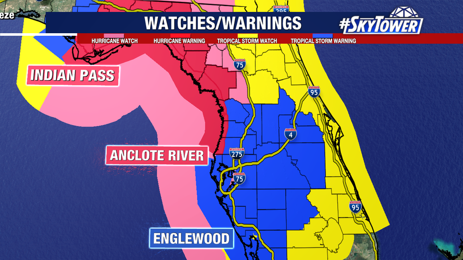
A tropical storm warning has been issued for the Gulf coast of Florida from Flamingo northward to Anclote River, including Tampa Bay, and west of Mexico Beach to the Walton/Bay County Line.
A tropical storm watch is in effect for Lake Okeechobee and Palm Beach/Martin County Line northward to the Savannah River.
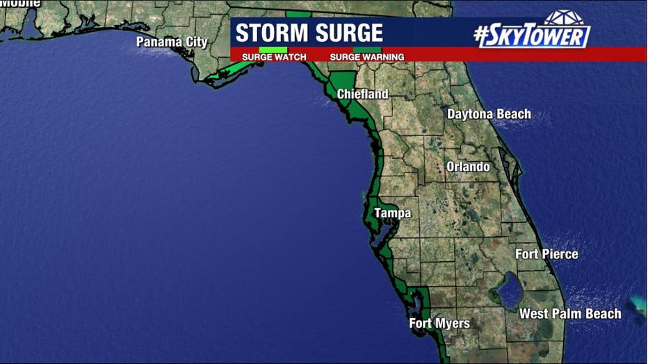
Mapped: Where Florida’s Gulf Coast is susceptible to Helene storm surge
A storm surge warning has been issued from Flamingo to Indian Pass, including Tampa Bay and Charlotte Harbor.
When will the storm impact the Bay Area?
FOX 13 meteorologists say impacts will likely be felt in the Bay Area starting Wednesday night, with the worst weather on Thursday.
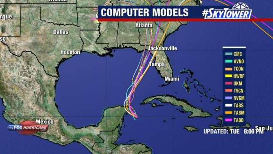
Models show Helene strengthening in the warm waters of the Gulf of Mexico and making landfall, possibly as a major hurricane, in the Big Bend area on Thursday. The exact timing and location will become clearer as the storm develops.
Any shift in the track to the east or west could significantly change how the storm will impact the Bay Area.
READ: Your guide to hurricane season 2024
What are the potential impacts?
FOX 13 meteorologists say life-threatening storm surge will be a major concern for coastal areas, with the potential for significant flooding.
"From Chassahowitzka north, you could be looking at a 10 to 15 foot storm surge," Dave Osterberg said.

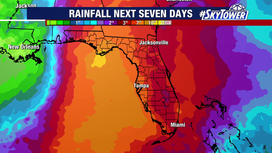
Heavy rain is expected throughout the Bay Area, especially on Thursday, with rainfall projections increasing closer to the coast.
Preparing for Helene
Governor Ron DeSantis declared a state of emergency for Florida on Monday, while several counties and cities have opened sandbag locations.
Several Bay Area counties have each declared a local state of emergency, with some school districts canceling classes later this week.
Mandatory evacuations are in place for some people living along the coast, low-lying areas and in manufactured homes or homes that could not withstand tropical-storm-force winds.
Officials with Hillsborough County and the City of Tampa are monitoring dozens of pumping stations to ensure all infrastructure is clear and functioning properly.
Officials in Manatee and Sarasota counties are checking on areas that received heavy flooding from Debby in August, while also monitoring the Lake Manatee Dam.
STAY CONNECTED WITH FOX 13 TAMPA BAY:
- Download the FOX Local app for your smart TV
- Download the FOX 13 News app for breaking news alerts, latest headlines
- Download the SkyTower Radar app
- Sign up for FOX 13’s daily newsletter