

Potential Tropical Cyclone 8 forms off coast of the Carolinas: NHC
TAMPA, Fla. - Potential Tropical Cyclone Eight, previously known as Invest 95L, formed off the Southeast U.S. coast on Sunday and is expected to become Tropical Storm Helene early this week, according to the National Hurricane Center.
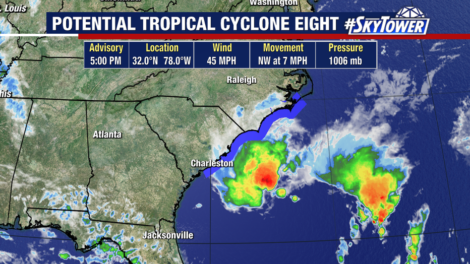
Potential Tropical Cyclone Eight is located a couple of hundred miles off the Southeastern U.S. coast.
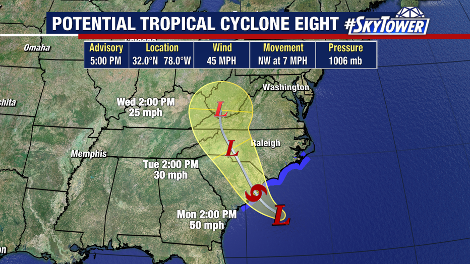
A Tropical Storm Warning is in effect for Edisto Beach, South Carolina northward to Ocracoke Inlet, North Carolina. The storm is expected to bring heavy rains and coastal flooding.
As of the NHC's 5 p.m. advisory, Potential Tropical Cyclone Eight has maximum sustained winds of 45 mph. It is moving northwest at 7 mph.
"But ironically enough, as it starts to develop, it's going to move right back on shore again. So even if it does develop, it shouldn't have a chance to become something sort of overly, you know, strong because it's going to move right back onshore again," shared FOX 13 News Meteorologist Dave Osterberg.
The NHC is giving the storm a 70% chance of strengthening over the next two days.
Gordon weakens
Gordon emerged off the coast of Africa several days ago and gained enough strength to become a tropical storm. However, it weakened to a depression on Sunday afternoon.
According to Osterberg, Gordon is on a "fast path to absolutely nowhere."

The NHC says the storm poses no threat to land.
It is forecast to slow down considerably through the middle of the week.
"It's going to be gone in a couple of days. And even if it doesn't, if it hangs around here for a while, eventually it'll get pulled to the north and either weaken or just kind of turn to the northeast," explained Osterberg.
FOXWeather.com contributed to this story.
STAY CONNECTED WITH FOX 13 TAMPA:
- Download the FOX Local app for your smart TV
- Download the FOX 13 News app for breaking news alerts, latest headlines
- Download the SkyTower Radar app
- Sign up for FOX 13’s daily newsletter