

No new named storms expected in August: Why are the tropics still inactive?

Hawaii's Big Island under hurricane warnings
Hurricane Hone and Hurricane Gilma are both expected to pass by Hawaii, according to FOX 13 Meteorologist Valerie Mills. Mills says while the Pacific is active, the Atlantic is still quiet.
TAMPA, Fla. - Ever since Hurricane Ernesto, there has been a quiet stretch of inactivity across the North Atlantic. This period is forecast to extend into September as no new named storms are expected to form over the next seven days.
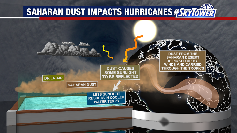
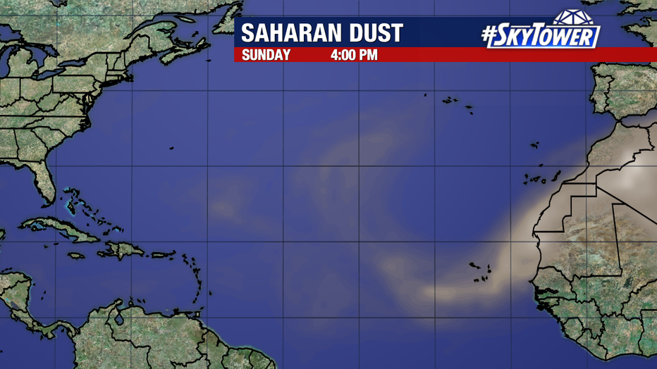
A driving factor of this is how plumes of Saharan dust are continuing to get swept across the Tropical Atlantic, effectively drying out most disturbances before they can show signs of development.
READ: '2004 Trifecta': Polk County produces documentary 20 years after direct hits from 3 hurricanes
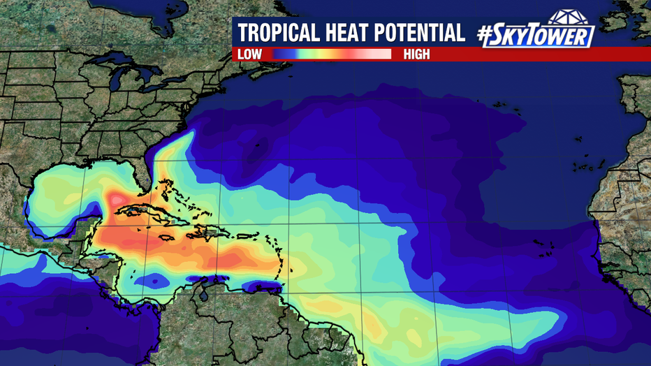
Additionally, tropical waves (the seeds of tropical storms and hurricanes) are encountering relatively cool sea surface temperatures off the coast of Africa. This contrasts the abnormally warm waters to their west that they are struggling to reach.
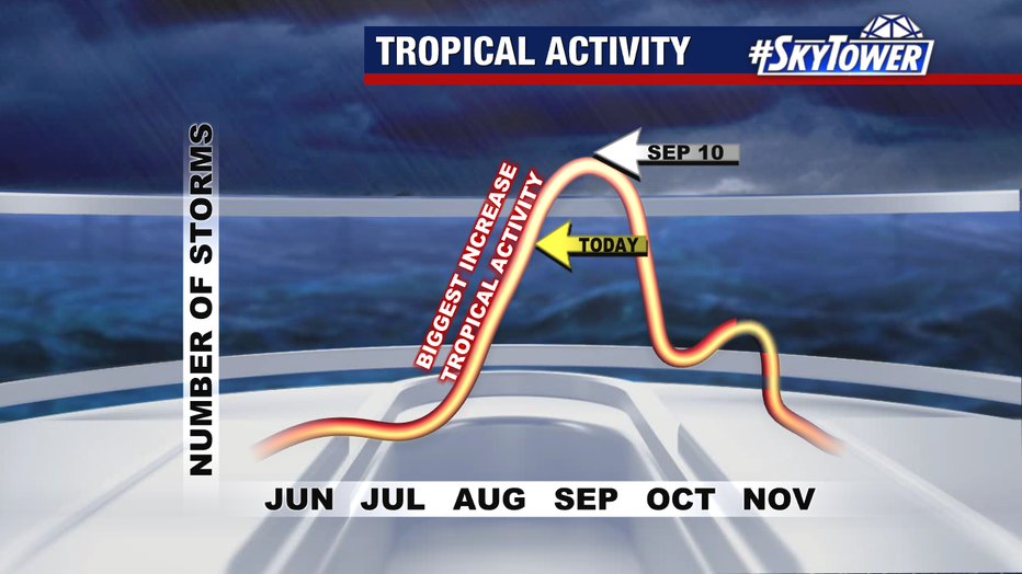
It’s important to note that we have over two-thirds of our hurricane season to go, and long-term signals are still pointing toward an active season. Sept. 10 marks the climatological peak of the season, with the month of September historically producing more U.S. land-falling storms than any other month.
STAY CONNECTED WITH FOX 13 TAMPA:
- Download the FOX Local app for your smart TV
- Download the FOX 13 News app for breaking news alerts, latest headlines
- Download the SkyTower Radar app
- Sign up for FOX 13’s daily newsletter