

TS Gordon continues slow trek, chance of development increases for disturbance off Southeast US coast
Tropical Storm Gordon expected to weaken
FOX 13 News Meteorologist Nash Rhodes says Gordon will likely weaken into a tropical depression and stay away from most, if not all, landmasses. A disturbance off the coast of the United States has a 50% chance of formation over the next week, according to Rhodes.
TAMPA, Fla. - Tropical Storm Gordon is expected to remain over open water for the next several days, according to the National Hurricane Center.
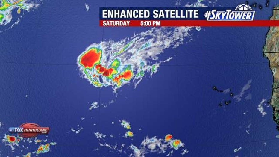
According to FOX 13 News Meteorologist Nash Rhodes, the storm is very disorganized and lopsided.
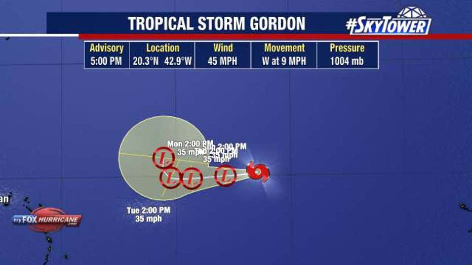
As of 5 p.m. on Saturday, the storm was located near latitude 20.3 North, longitude 42.9 West and had maximum sustained winds of 45 mph.
"The center of this system is out here on the west side of it, with all that thunderstorm activity draped on the east side of it, because of the high amounts of shear that it's currently dealing with out in the middle of the Atlantic," explained Rhodes.
The NHC says Gordon will likely weaken into a tropical depression over the next few days and then strengthen and turn back to the north at some point toward the middle of next week.
"If it does so, that would likely keep it away from the United States and away from most, if not all landmasses as a whole, which would be the first named storm that we've had so far this season to avoid making landfall at some point in its lifespan," said Rhodes.
A disturbance off the Southeast US coast is also being tracked. The NHC is giving it a 50% chance of formation over the next seven days and a 40% chance over the next two days.
"It's really into the beginning of next week that we'll be watching for this to have a chance to take on tropical characteristics as it works its way back to the west northwest, potentially toward the Carolinas or eastern sections of Georgia," shared Rhodes.
STAY CONNECTED WITH FOX 13 TAMPA:
- Download the FOX Local app for your smart TV
- Download the FOX 13 News app for breaking news alerts, latest headlines
- Download the SkyTower Radar app
- Sign up for FOX 13’s daily newsletter