

Hurricane Beryl moving away from Jamaica; headed toward Cayman Islands
Beryl encounters wind shear as it starts to weaken
FOX 13 meteorologist Jim Weber has the latest on Hurricane Beryl as the storm moves away from Jamaica and heads toward the Cayman Islands.
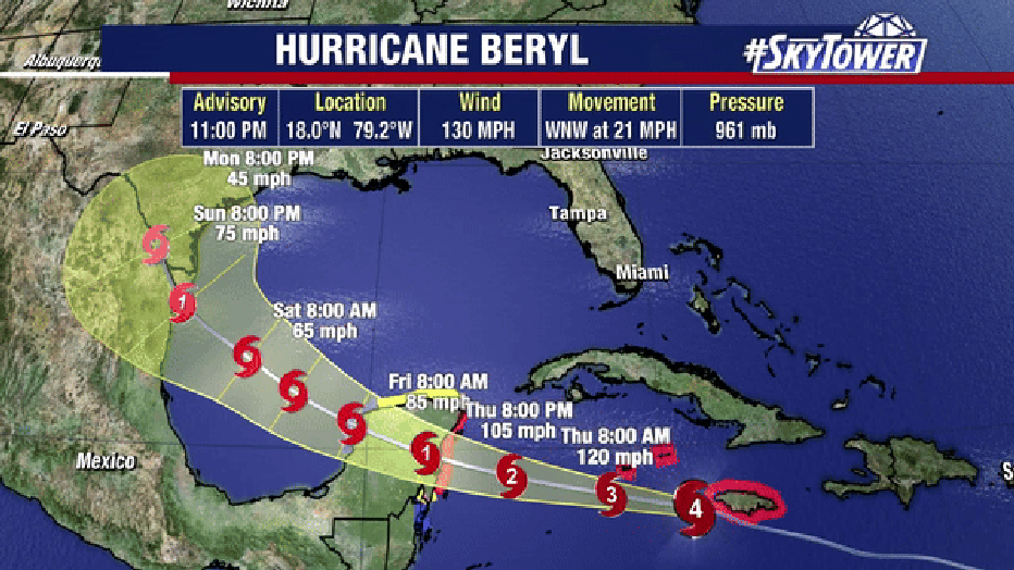
TAMPA, Fla. - Hurricane Beryl is beginning to move away from Jamaica, but dangerous conditions continue to be an issue as the storm approaches the Cayman Islands.
According to the National Hurricane Center, as of 11 p.m., Beryl now carries maximum sustained winds of 130 mph and remains a Category 4 hurricane.
The storm is expected to notably weaken over the next few days, according to FOX 13 Meteorologist Nash Rhodes.
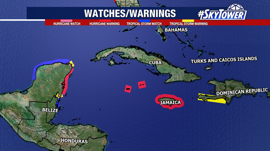
In addition to major storm surge, the NHC anticipates "devastating hurricane-force winds" to continue impacting Jamaica into early Thursday.

Hurricane warnings remain in effect for Jamaica, The Cayman Islands, and portions of the Yucatán Peninsula. A slew of other watches and warnings are in effect for nearby areas.
Beryl is still expected to make landfall in the Yucatán Peninsula early on Friday as a hurricane. After spending most of Friday over land and weakening, Beryl should re-emerge over the western Gulf of Mexico as a tropical storm.
There is still uncertainty with Beryl's track in the Gulf. A weakening ridge of high pressure may try and pull Beryl toward the coast of Texas or steer the system into eastern Mexico if it remains strong.
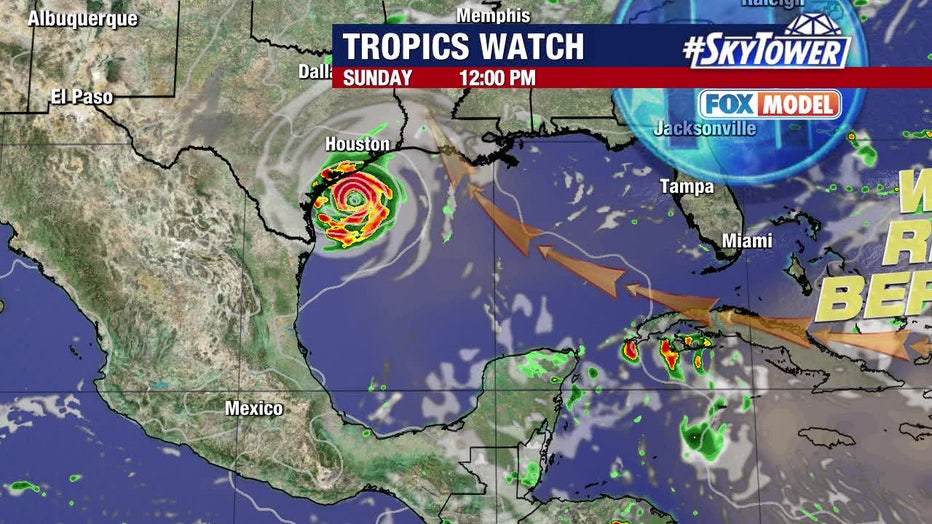
Additionally, a stronger storm would likely try and pull farther north. Interests in the western Gulf of Mexico should monitor this system carefully.

Behind Beryl, meteorologists are also watching Invest 96L near the Lesser Antilles. This tropical wave is unlikely to become a named storm as it continues to be engulfed by Saharan dust. It has a low (20%) chance of formation over the next week.