

New tropical disturbance off Texas coast among 5 being tracked for development: NHC
New tropical disturbance off Texas coast among 5 being tracked for development
FOX 13 meteorologist Jim Weber is tracking the very active tropics.
TAMPA, Fla. - The National Hurricane Center is now tracking five tropical disturbances in the Atlantic, as activity in the tropics continues to heat up after lying dormant.
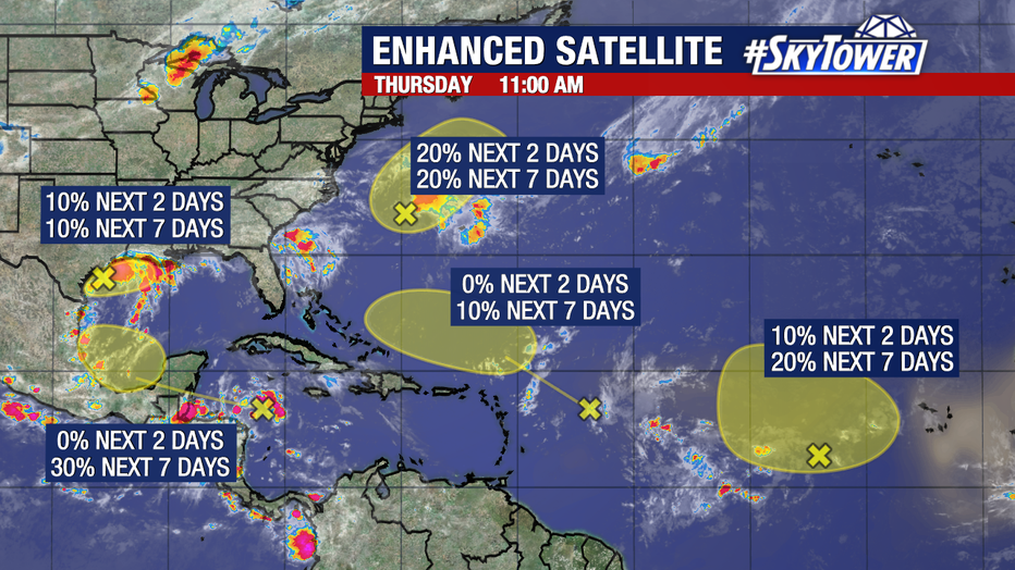
Although development for any of these disturbances isn't imminent for the time being - with the highest chance of development sitting at 30 percent, according to the NHC - the tropical Atlantic has seen a quick uptick in activity after seeing very few disturbances for weeks.
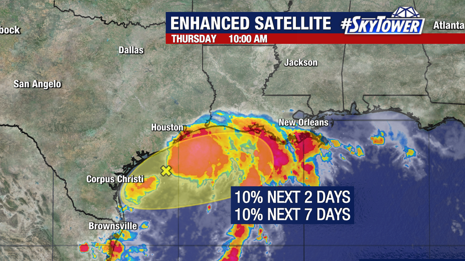
The new disturbance off the coast of Texas is producing widespread disorganized showers and thunderstorms across the northwestern Gulf of Mexico. This includes near the coasts of Louisiana and Texas.
PHOTOS: Heavy rain leads to flooding, rescues in Tampa
According to the NHC, development of this system is unlikely, but heavy rainfall is expected across portions of the northern Gulf Coast over the next day or so.
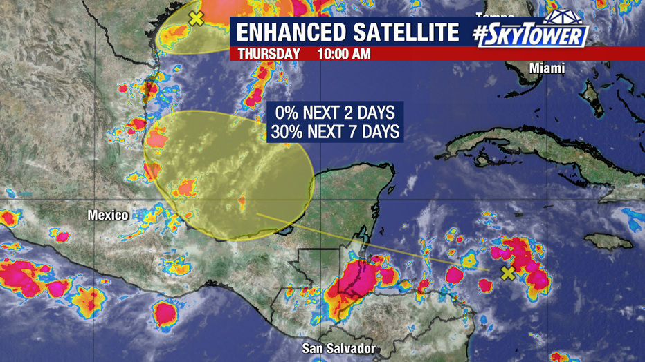
Another tropical disturbance located over the western Caribbean is moving westward quickly at about 20 mph and has a 30 percent chance of development over the next week.
The system is forecasted to move across the Yucatán Peninsula and then into the southwestern Gulf of Mexico.
STAY CONNECTED WITH FOX 13 TAMPA:
- Download the FOX Local app for your smart TV
- Download the FOX 13 News app for breaking news alerts, latest headlines
- Download the SkyTower Radar app
- Sign up for FOX 13’s daily newsletter
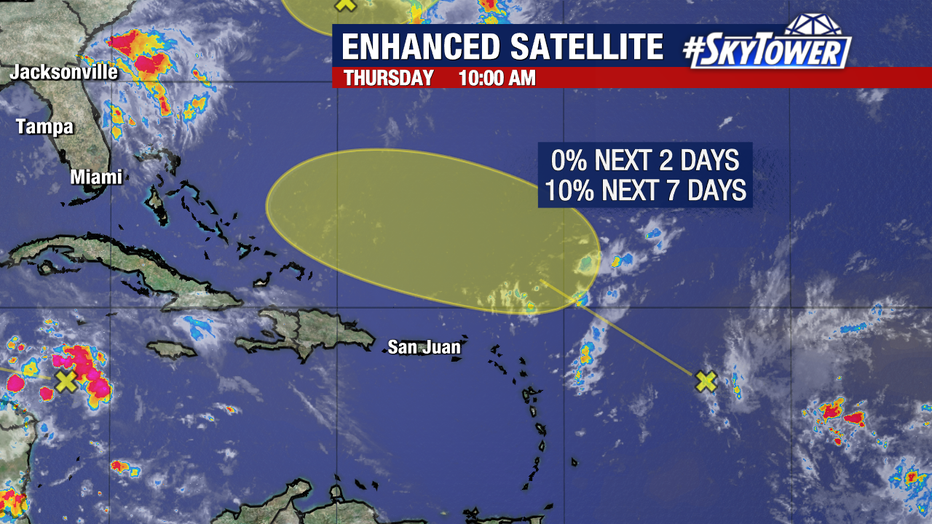
By early next week, there is now a low (10%) chance of formation for a tropical wave in the Central Tropical Atlantic. This is after passes north of the Greater/Lesser Antilles early next week.
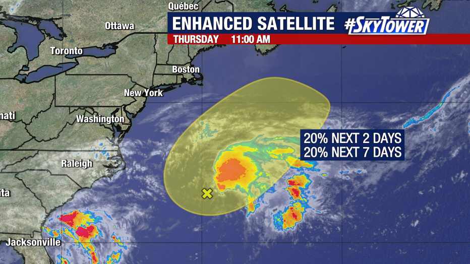
The NHC is also watching an area of low pressure (Invest 99L) producing disorganized showers and storms a few hundred miles east of North Carolina. This could gain subtropical characteristics as it generally moves northeast over the next few days.
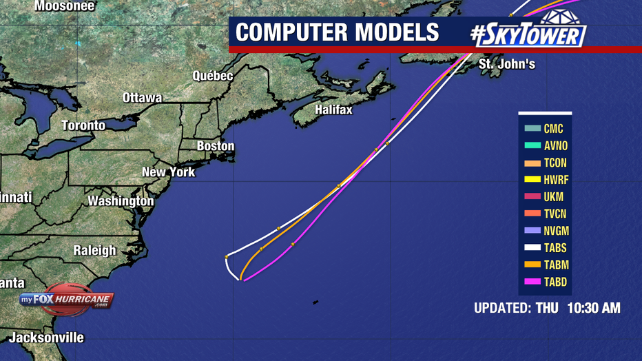
Weather forecast models keep the disturbance well off the coast of the United States. They eventually bring it into a less favorable environment for formation, over the cooler waters of the North Atlantic this weekend. It has a low (20%) chance of development over the next two days.

A broad area of low pressure over the eastern tropical Atlantic now has a low (20%) chance of forming within the next week.
Regardless, it will likely track north/northwest and remain in the central Atlantic.
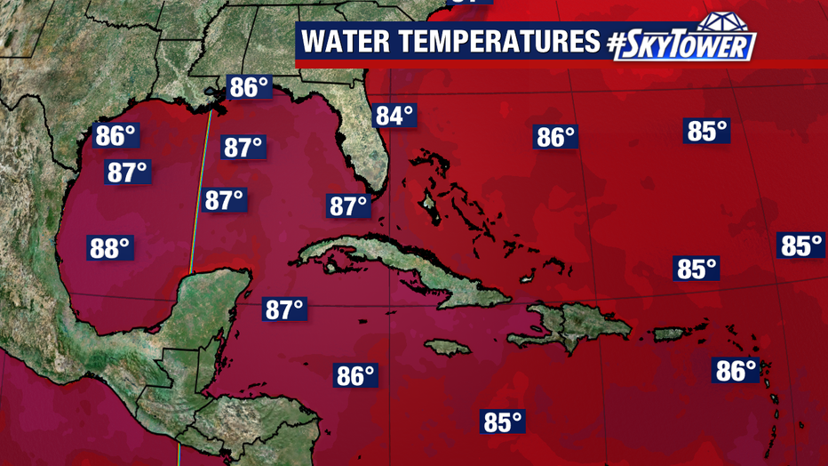
Through the month of August, the tropical Atlantic was quiet, but as the peak of hurricane season nears in September, activity seems to be ramping up.