

Tracking the Tropics: Tropical Storm Beryl forms, expected to become hurricane in the coming days

Tropical Storm Beryl forms in Atlantic
FOX 13 meteorologist Jim Weber has the latest track for Tropical Storm Beryl.
TAMPA, Fla. - Tropical Storm Beryl has formed in the Atlantic and is expected to become a hurricane in the coming days, the NHC forecasted.
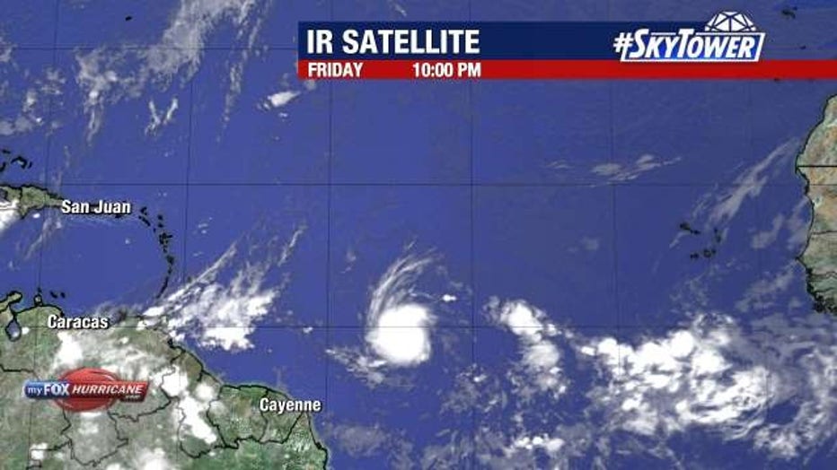
FOX 13 meteorologist Nash Rhodes says the system is expected to strengthen into a hurricane after entering into the eastern Caribbean. As of 11 p.m. Friday, it has sustained winds of 40 mph and is moving west at 18 mph.
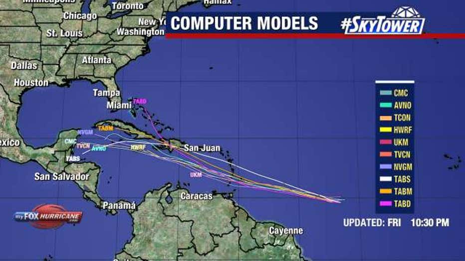
Models are in strong agreement regarding Beryl’s track into the eastern and central Caribbean early next week. From there, there is still uncertainty regarding where it would head next.
Interests in the Lesser Antilles should carefully track the progress of this system. Unseasonably warm sea surface temperatures, ample tropical moisture, and a lack of strong wind shear will provide a window of opportunity for the system to strengthen into a Category 2 hurricane in the Eastern Caribbean. This would be the first time since 1933 that any hurricane has formed in June in that region.
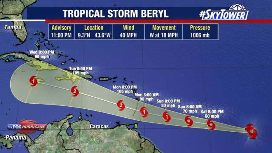
The storm is expected to move west at 15 to 20 mph and approach the Windward Islands by the end of the week, but its path past that is unclear. The NHC reported Hurricane or Tropical Storm Watches could be required for portions of the Windward and southern Leeward Islands.
TRACKING THE TROPICS: Invest 95L likely to become tropical depression or storm this weekend
We have plenty of time to monitor this system in the contiguous United States. It is just less than 3,000 miles off our coastline and there are no immediate threats to the Florida Peninsula at this time.
Meanwhile, Invest 94L continues to produce disorganized shower and thunderstorm activity in the Western Caribbean near the Southwest Gulf of Mexico, presenting some chances of development over the next few days.
The NHC gives this storm a 30 percent chance of development over the next 2 days and a 30 percent chance of development through the next week.
SIGN UP: Click here to sign up for the FOX 13 daily newsletter