Tropical disturbance in Gulf likely bringing heavy rain to Florida despite lower chance of development

Tropical disturbance in Gulf likely bringing heavy rain to Florida despite lower chance of development
FOX 13 meteorologist Jim Weber is tracking the tropics.
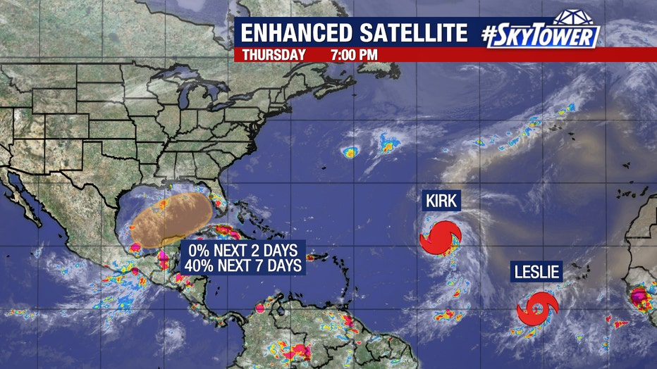
TAMPA, Fla. - An area of low pressure in the Gulf of Mexico could bring several inches of rain to parts of Florida, including the Tampa Bay area, by early next week.
As of Thursday evening, the system remains disorganized with the National Hurricane Center giving it a 40 percent chance to develop over the next seven days.
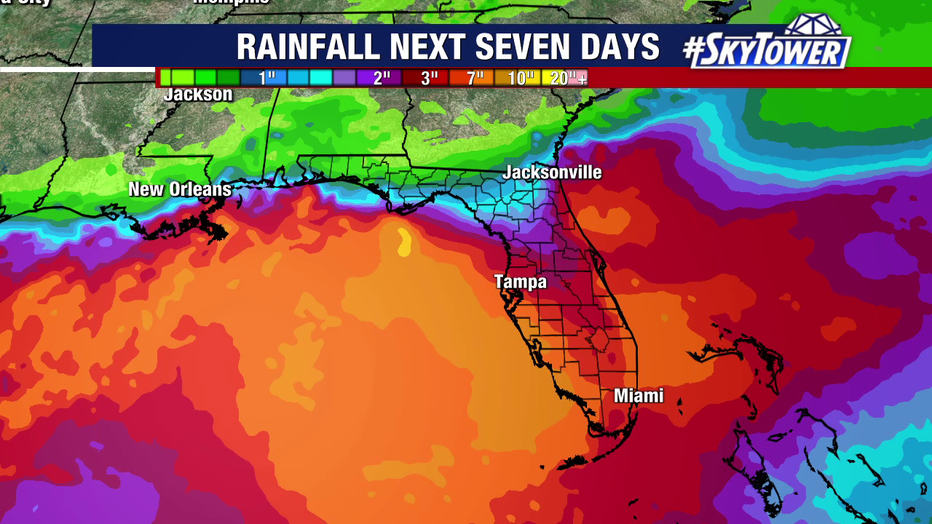
FOX 13 Meteorologist Dave Osterberg says, regardless of whether the disturbance develops into a named storm, it will bring heavy rain to areas that dealt with severe flooding from Hurricane Helene.

"We could get our entire [average] October rainfall early next week, which is only about two and a half inches," Osterberg said. "But the computer models are bringing 4 or 5 inches of rain to Central Florida with 8 to 10 inches over South Florida."

Several inches of rain could fall throughout the Tampa Bay area over the next seven days, according to FOX 13 Meteorologists.
As for the timeline, tropical moisture is expected to move across the state late Sunday, with rain continuing through Monday and into Tuesday, according to Osterberg.
"At this point, there are no computer models that call for any significant hurricane or anything like that," Osterberg said. "They just keep it a weak, sort of broad low pressure with a lot of rain."
Other activity in the tropics
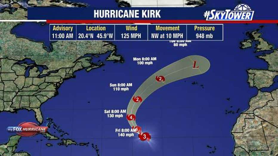
Hurricane Kirk is a major hurricane moving over the Atlantic Ocean and is expected to keep gaining strength, reaching at least Category 4 status, but it's expected to stay in the open Atlantic.

Tropical Storm Leslie formed Wednesday night and will also go out to sea, taking a similar path to Kirk.
STAY CONNECTED WITH FOX 13 TAMPA BAY:
- Download the FOX Local app for your smart TV
- Download the FOX 13 News app for breaking news alerts, latest headlines
- Download the SkyTower Radar app
- Sign up for FOX 13’s daily newsletter

