

Sandbag sites open around Bay Area ahead of tropical system
NEW PORT RICHEY Fla. - While mainly South Florida will get the brunt of heavy rain this weekend from a tropical system, some Bay Area governments still want to make sure residents are prepared, especially those living in low-lying areas.
Manatee County
Twelve pallets of sandbags are being distributed at 4000 Gulf Drive, Holmes Beach, on a first-come, first-served basis with a ten-bag-per-person limit.
General public self-serve locations are available at the Rubonia Community Center, 1309 72nd Street E in Palmetto and the Myakka Community Center at 10060 Wauchula Rd. in Myakka City.
Pasco County
The county has opened two sandbag stations. Both are self-serve and open 24 hours to residents.
Pasco County Public Works (C-Barn)
30908 Warder Road, San Antonio
Magnolia Valley Golf Course
7223 Massachusetts Ave., New Port Richey
Residents are asked to bring a shovel.
City of Tampa
The City of Tampa will have bags, sand and shovels available. There will also be volunteers available to help those who cannot fill their own sandbags.
Himes Avenue Complex
4501 S. Himes Avenue, Tampa, FL 33611
Al Barnes Park
2902 N. 32nd Street, Tampa, FL 33605
MacFarlane Park
1700 N MacDill Avenue, Tampa, FL 33607
Site between Maxwell and Renfrew
Sandbag sites schedule
Friday, June 3 from 3:00 p.m. to 7:00 p.m.
Saturday, June 4 from 7:00 a.m. to 7:00 p.m.
Sunday, June 5 from 7:00 a.m. to 7:00 p.m.
Sarasota County
No information yet
Highlands County
No information yet
Desoto County
No information yet
Hardee County
No information yet
Polk County
No information yet
Hillsborough County
No information yet
Hernando County
No information yet
Citrus County
No information yet
LINK: Track the tropics on MyFOXHurricane.com
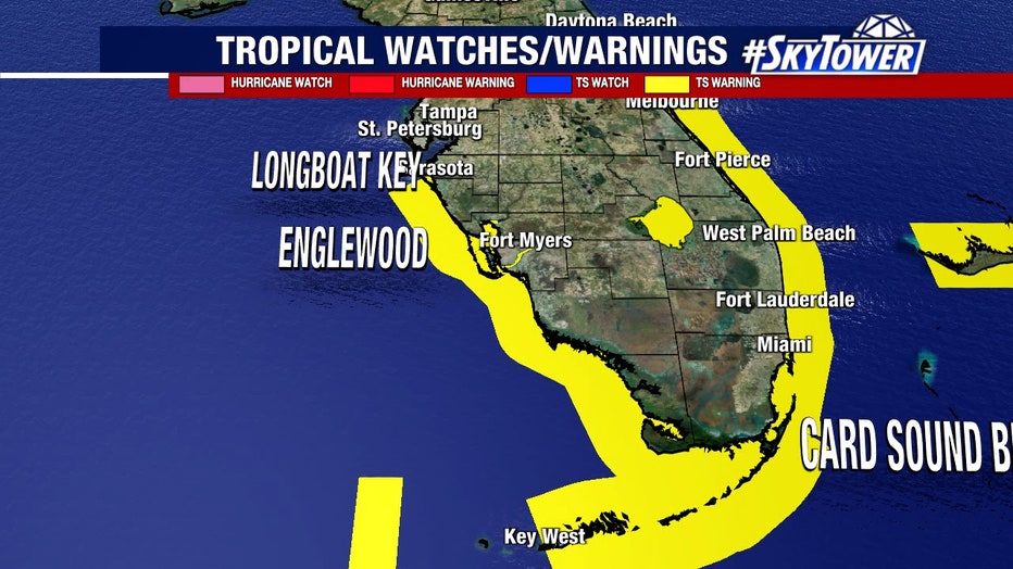
The National Hurricane Center predicts that rainfall up to 10 inches is possible in places in South Florida from this storm, which is not expected to produce huge winds or major storm surge. Still, flooding is likely and winds could be somewhat strong.
The Hurricane Center said maximum sustained winds from the system as of Thursday afternoon were about 35 mph with higher gusts. It’s expected to become a tropical storm sometime Friday, which means higher winds but not at hurricane levels.
"Heavy rains will begin to affect South Florida and the Keys Friday and continue through Saturday," the Hurricane Center said in an online post. Also predicted is storm surge and flooding, the severity of which depends on the timing of tides.