

Beryl re-enters Gulf of Mexico, expected to re-intensify into hurricane as storm approaches Texas
TAMPA, Fla. - Beryl is re-entering the Gulf of Mexico as a tropical storm after moving through the Yucatán Peninsula in Mexico, but it is expected to re-strengthen into a hurricane before approaching the coast of Texas.
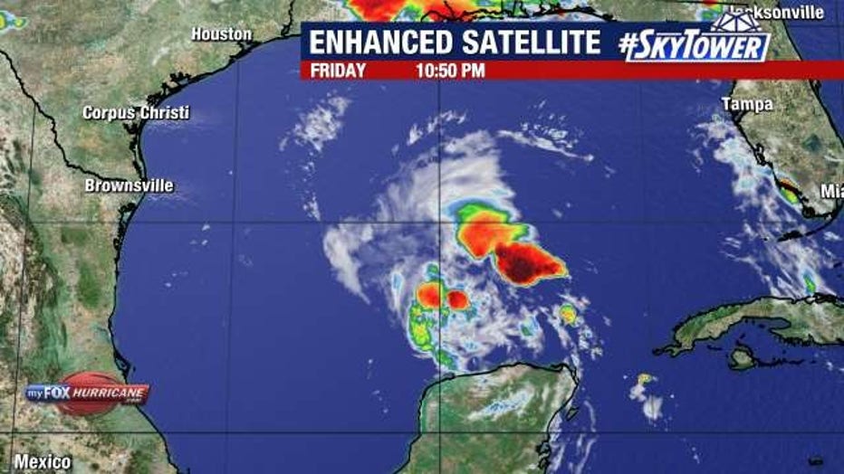
Winds are at 60 mph as of 11 p.m. Friday, with the storm moving west at 13 mph. Then, according to FOX 13 Meteorologist Nash Rhodes, abnormally warm waters will allow it to restrengthen back into a Category 1 hurricane as the storm turns northwest.
It should then make landfall for the third time in either northeast Mexico or southern Texas, which appears more and more in the forecast cone.
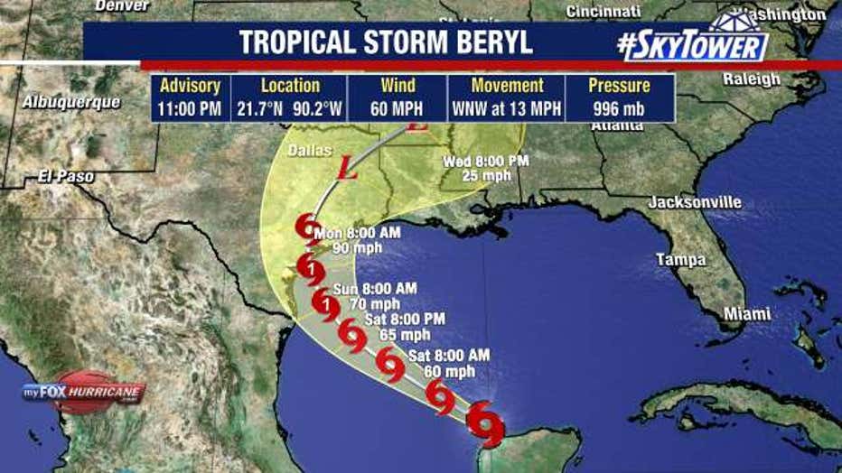
Rhodes said an area of high pressure that has kept Beryl from moving any closer to the United States is retreating eastward, allowing for Beryl to potentially threaten landfall in Texas more.
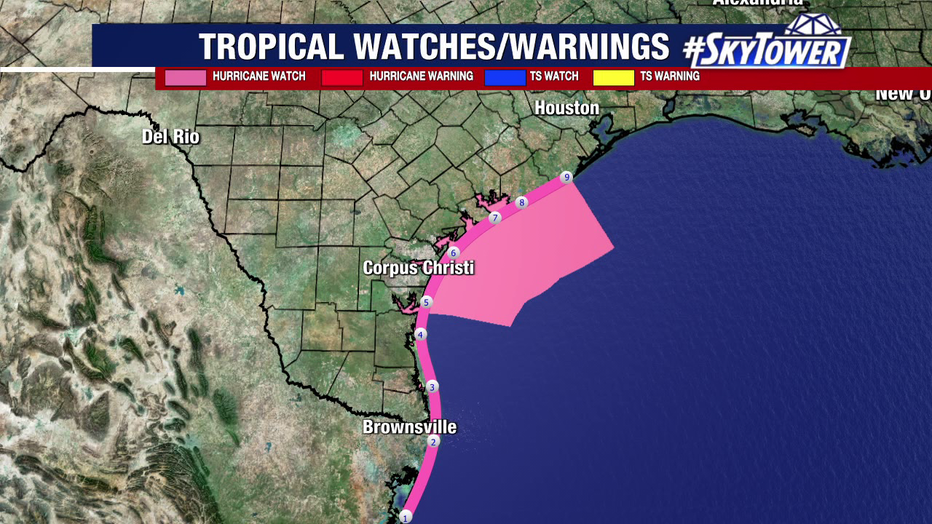
The entire coast of Texas is now included in the cone, with a stretch of the coast under a hurricane watch.
READ: Tampa resident Miki Sudo breaks women's hot dog eating contest record
According to the National Hurricane Center, there is an increasing risk of hurricane-force winds, life-threatening storm surge, and flooding from heavy rainfall in northeastern Mexico and the lower/middle Texas coast late Sunday and Monday.
Meanwhile, Invest 96L, which was the other tropical wave the National Hurricane Center was monitoring, no longer has any chance of formation. Beryl is currently the only tropical disturbance the NHC is keeping tabs on.
Rhodes said the good news is lots of Saharan dust in the Atlantic basin could keep other tropical disturbances from forming for the time being.
SIGN UP: Click here to sign up for the FOX 13 daily newsletter
WATCH FOX 13 NEWS