Tropical disturbance in Caribbean Sea sees increased chance of development
TAMPA, Fla. - As the final month of the Atlantic hurricane season begins, the National Hurricane Center is watching three areas of interest in the tropics with chances of development in the coming days.
Disturbance in the Caribbean Sea
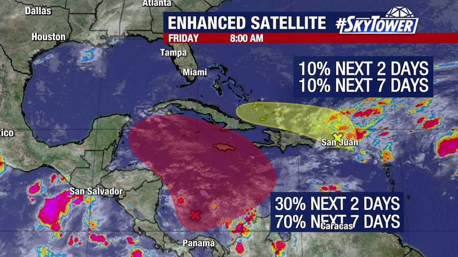
The NHC is giving a wave in the southern Caribbean Sea a 30 percent chance to develop in the next two days, with odds increasing to 70 percent over the next seven days.

The National Hurricane Center is watching multiple potential systems in the tropics as the final month of hurricane season begins.
Where could it go if it develops?
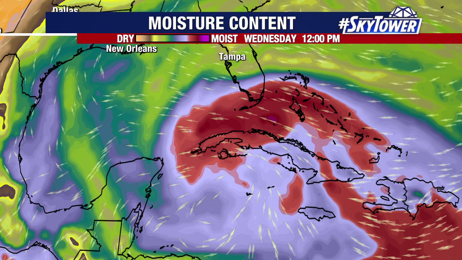
FOX 13 Meteorologist Dave Osterberg says high pressure will build over the Atlantic Ocean in the days ahead, which will help push any potential system northwest toward the Gulf of Mexico.

The NHC is giving a wave in the southern Caribbean Sea a 30 percent chance to develop in the next two days, with odds increasing to 70 percent over the next seven days.
How will water temperatures impact development?
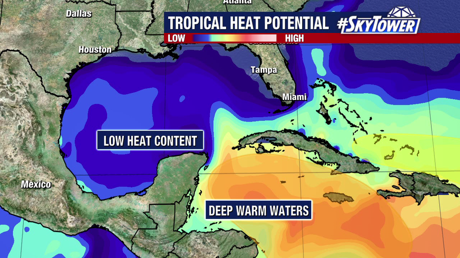
The deep, warm waters of the Caribbean Sea will give the disturbance plenty of fuel to work with, according to Osterberg, but that would change if it enters the Gulf – making for a much different scenario than with Hurricanes Helene and Milton.

Any potential system moving into the Gulf of Mexico will encounter cooler water temperatures and increased wind shear, forecasters say.
"There's a much lower heat content than what we had just six to eight weeks ago, so that will make a difference into how all this plays out," Osterberg said. "Plus, probably some wind shear in the Gulf of Mexico, as well. So not the same type of setup once you get into November."
Osterberg says there's still plenty of uncertainty, and it could be next week before there are definitive answers.
Elsewhere in the tropics
Another disorganized cluster of showers and storms near Puerto Rico has a 10 percent chance of developing in the next two to seven days, according to the NHC.
A third area of low pressure is moving over the northern Atlantic and is headed east, staying away from the U.S., with a 40 percent chance of developing in the next week.
The next system to get a name would be called Patty.
The Atlantic hurricane season officially ends Nov. 30.
STAY CONNECTED WITH FOX 13 TAMPA BAY:
- Download the FOX Local app for your smart TV
- Download the FOX 13 News app for breaking news alerts, latest headlines
- Download the SkyTower Radar app
- Sign up for FOX 13’s daily newsletter

